
Tag "India"
GIS
Geological Survey of India to Map Geological Potential Areas of the Country
Geological Survey of India (GSI) will soon take up the ambitious National Airborne Geophysical Mapping project covering 8 lakh sq kms including the Obvious Geological Potential (OGP) area, which includes
Tenders and RFP's
RFP for Upgradation and Maintenance of NSDI’s India Geoportal
“Invitation for Expression of Interest for Proposal for Upgradation and Maintenance of NSDI’s India Geoportal” Department of Science and Technology, Government of India, invites Expression of Interest (EOI) in sealed
Remote Sensing
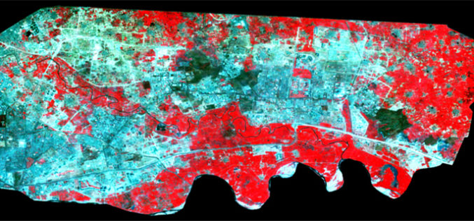
Spatiotemporal Analysis of Noida Using Remote Sensing and GIS Approaches
Spatiotemporal analysis refers to an analysis having both spatial extension and temporal duration. Remote sensing has provided a great tool to quantify changes using satellite data in our area of interest. Population
