
Tag "India"
DGCA to Airlines: Use GAGAN or Face Consequence
Mumbai – According to recent news by the Mumbai Mirror, the government has warned domestic airlines of `consequences’ if they did not adopt the Rs 774 crore GPS-Aided Geo Augmented
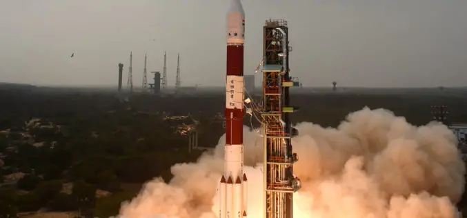
ISRO Successfully Launches RESOURCESAT-2A Remote Sensing Satellite
In its thirty-eighth flight (PSLV-C36), ISRO’s Polar Satellite Launch Vehicle successfully launched the 1235 kg RESOURCESAT-2A Satellite December 07, 2016 morning from Satish Dhawan Space Centre SHAR, Sriharikota. This is
French Defence Major Thales Eyes Indian UAV Market
French defence major Thales is eyeing the multi-billion dollar Indian UAV market as it aims to increase its presence here by also dipping into the small and medium scale defence
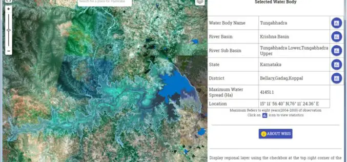
Temporal Repetitive Mapping of Water Bodies Across India
National Remote Sensing Centre (NRSC), ISRO at Hyderabad monitors the status of all the water bodies in the country using satellite images and provides water spread area information on a

“India Should Build Its Own Space Station”
India should actively get into building its own space station in the Low Earth Orbit (LEO) as its next space frontier since the time is opportune for this, a retired

Pakistan Express Serious Concern Over India’s Geospatial Bill
According to recent news by The Economics Times, Pakistan has expressed serious concern to the United Nations Security Council (UNSC) over the depiction of Jammu and Kashmir in India’s draft geospatial

India: “The Geospatial Information Regulation Bill, 2016”
The Ministry of Home Affairs, Government of India has requested for comments/suggestions on draft “The Geospatial Information Regulation Bill, 2016”. “To regulate the acquisition, dissemination, publication and distribution of geospatial information
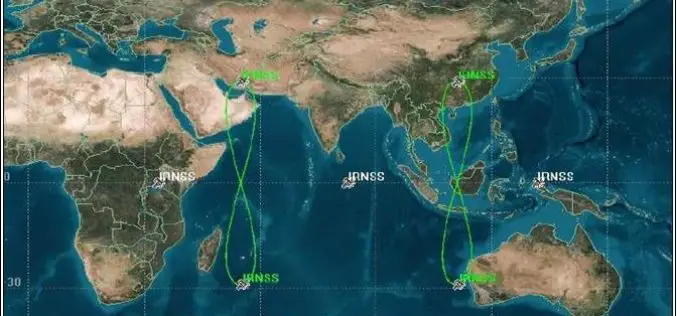
PSLV-C33 Successfully Launches India’s Seventh Navigation Satellite IRNSS-1G
Apr 28, 2016 – In its thirty-fifth flight (PSLV-C33), ISRO’s Polar Satellite Launch Vehicle successfully launched the 1425 kg IRNSS-1G, the seventh satellite in the Indian Regional Navigation Satellite System (IRNSS)

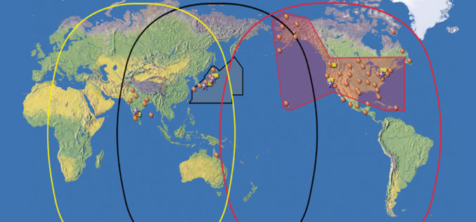
BRICS Nations to Exchange Remote Sensing Data of the Earth
According to recent news by Sputnik News, The BRICS countries are working to implement an initiative of sharing information on the Earth’s remote sensing, which will allow to swiftly respond to emergency situations and disasters, Russia’s

GAIL to Use Drones to Secure Gas Pipelines
GAIL India, the country’s biggest gas transporter, will deploy drones on a pilot basis on its main trunk pipeline as part of higher safety measures it is implementing to secure
