
Tag "GSI"
GIS
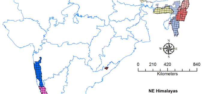
Geological Survey of India to Complete Landslide Susceptibility Mapping in 2018
Kolkata, December 6, 2017 (IANS) : The Geological Survey of India (GSI) is set to complete generation of Landslide Susceptibility Maps – covering an area of 1.71 lakh sq km

GIS
JNARDDC and MRSAC are Developing Bauxite Mining App
Nagpur-India: According to recent news by The Times of India, the Jawaharlal Nehru Aluminium Research Development and Design Centre (JNARDDC), Nagpur, in collaboration with the Maharashtra Remote Sensing Application Centre (MRSAC),
Remote Sensing
Geological Survey of India Finds Huge Gold Deposits
Karnataka – According to recent news by the Deccan Herland, the Geological Survey of India (GSI) has found large gold deposits spread over 600 sq km between Shikaripur in Shivamogga
