
Tag "Google"

How Google is Using Satellite Imagery for Mapping Wildfires?
Google Earth Engine is at the core of processing satellite imagery for mapping wildfire. The satellite images then processed using Google Earth Engine processing libraries for data analysis.
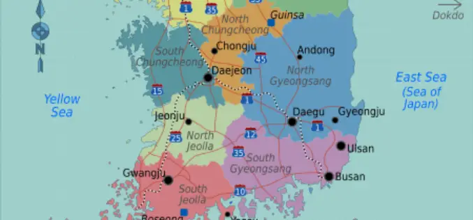
South Korea Refuses Google to Use Official Mapping Data
According to the recent news reported by IANS – South Korea has refused to grant permission to Google to use the official maps of the country, citing security concerns with neighbouring

Google Joins UNICEF To Combat Zika Virus
Google has joined the United Nations Children’s Emergency Fund (UNICEF) to help map the Zika virus spread to anticipate and prevent future outbreaks using open source. The recent Zika virus outbreak
Unfettered Display of Geospatial Data Pose National Security
It is essential to come up with legislation for the dissemination of images and geospatial data in the public domain before according permission to service providers such as Google as
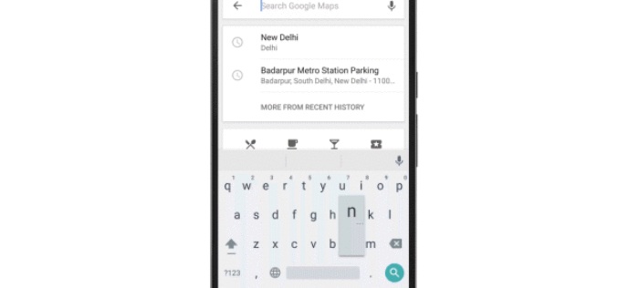
Google Maps Now Available Offline in India
Almost a week after announcing it in the US, last week Google has brought its Google Maps offline service to India. Google’s offline map makes the popular navigation and mapping tool
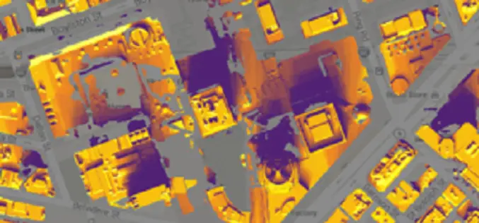
Project Sunroof – Google New Mapping and Analysis Tool for Solar Customer
Planning to setup solar panel, but have little knowledge or no knowledge. Google has brought the solution to make installation of solar panel easy and understandable. Project Sunroof is Google
Celebrate Google Earth 10 Birthday with Two New Features
Happy Birthday, Google Earth! It has been a full decade to the launch of Google Earth, has provided the capability to visualize and analyze geographic data for various scientific applications

Google Maps Will Soon Alert Drivers about Railroad Crossings
According to The New York Times, the Federal Railroad Administration, United States of America and Google have agreed to update its maps with crossing locations. The new maps will ensure
Esri and NT Concepts Help Transition Google Earth Enterprise Customers
Meeting the Requirements of the Intelligence Community a Top Priority Redlands, California—In coordination with Google, Esri is providing replacement software and training to customers and partners using Google’s enterprise geospatial

Hyderabad – First City in India to Get Google Street View
The Telangana government has agreed to keep sensitive defence installations in Hyderabad out of Google Street View and the union home ministry is expected to soon give permission for the
