
Tag "GNSS"

Trimble GNSS Smart Target Base Station Provides Simplified Map Production from UAVs
High-Performance GNSS Reference Station and Ground Control in One Easy-to-Deploy Package BERLIN, Sept. 26, 2017—Trimble (NASDAQ: TRMB) announced today the release of the Trimble® GNSS Smart Target Base Station for

Indian Railways to Install GPS in all Hand-pushed Trolleys Used for Track Inspection
September 8, 2017 – PTI – The railway ministry has decided to install GPS trackers in all hand-pushed trolleys used to inspect the tracks. In a letter to all zonal

Trimble Webinar: TBC Power Hour – Network Adjustment vs. Traverse Adjustment
TBC Power Hour – Network Adjustment vs. Traverse Adjustment AUGUST 30, 2017 | 08am MT or 04pm MT Geospatial Webinars offer attendees the opportunity to learn more about products, explore
TerraGo Adds TopCon® GNSS Receiver Integration to Mobile Data Collection Platform
With TerraGo Magic, partners and customers can build custom mobile apps integrated with Sokkia high-accuracy receivers that deliver RTK cm-level performance to smartphones and tablets Washington, D.C. – August 14,
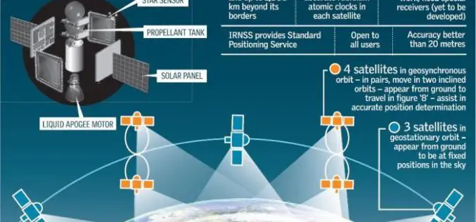
Isro to Sign MoU with CSIR-NPL for Time and Frequency Traceability Services for NavIC
According to recent news reported by TOI, the Indian Space Research Organisation (ISRO) will on Friday sign an MoU with CSIR-National Physical Laboratory (NPL) for time and frequency traceability services. The move
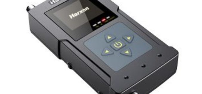
Harxon Releases Rover Radio for RTK Surveying and GNSS Positioning
Harxon has introduced an advanced, high-speed, Bluetooth-enabled wireless rover radio.The HX-DU1603D, designed for GNSS/RTK surveying and precise positioning, will be showcased this September at the Intergeo trade show in Berlin. The HX-DU1603D
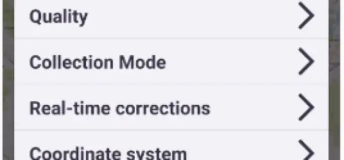
Trimble Introduces New Android Application for Field Surveying and Data Collection
Easy-to-Use Trimble Penmap for Android Simplifies Field Work SUNNYVALE, Calif., July 26, 2017—Trimble (NASDAQ: TRMB) introduced today Trimble® Penmap® for Android™, a cloud-connected application for field surveying and high-accuracy Geographic
TBC Webinar: TBC Power Hour – Defining and Working with Grid and Ground Coordinates
TBC Power Hour – Defining and Working with Grid and Ground Coordinates JULY 26, 2017 | 08am MT / 4pm MT Grid Coordinates. Ground Coordinates. Two fundamental concepts for surveyors
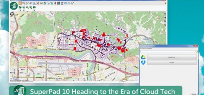
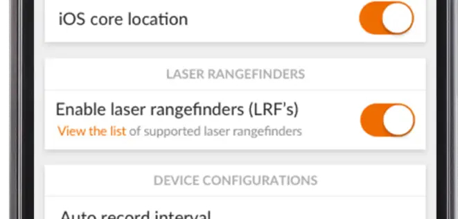
SuperPad 10 Heading to the Era of Cloud Tech
After years of research and development, the functionality of SuperPad, the professional mobile GIS software, is able to meet various demands of fieldworks. SuperPad 10, the new version released this
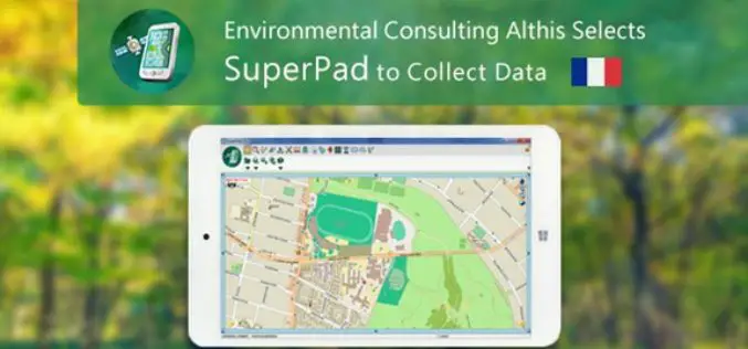
French Environmental Consulting Althis Selects SuperPad to Collect Data
Under the assistance of Géo.RM, Supergeo’s partner in France, the excellent mobile GIS software- SuperPad is earlier selected by the environmental consulting firm Althis for spatial data collection. Located in
