
Tag "Global Mapper"

Global Mapper v.18 Now Available with Improved User Interface and Full Range Rendering of 3D Data
Blue Marble Geographics is pleased to announce the immediate availability ofGlobal Mapper version 18 . The culmination of an extensive design and development effort, this major version release boasts a
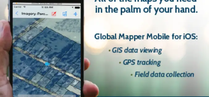
Global Mapper Mobile is Now Available for iOS
Blue Marble Geographics are pleased to announce the immediate availability of Global Mapper Mobile for iOS, a field-optimized version of the desktop software. Global Mapper Mobile offers powerful GIS data
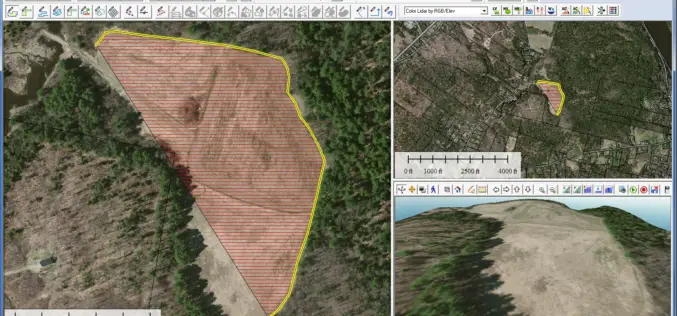
Global Mapper 17.2 Released with New Map Book Creation Tool and Cutaway Terrain View
Hallowell, Maine – May 17, 2016 – Blue Marble Geographics (bluemarblegeo.com) is pleased to announce the immediate availability of Global Mapper version 17.2. This upgrade to the version 17 release
Global Mapper SDK v17.1 Released with Updates and Performance Improvements throughout the Toolkit
Hallowell, Maine – March 31, 2016 – Blue Marble Geographics (bluemarblegeo.com) is pleased to announce the immediate availability of version 17.1 of the Global Mapper Software Development Kit (SDK) along
Blue Marble Names Global Mapper Best Commercial GIS Software Available for $499
Hallowell, Maine – Blue Marble Geographics (bluemarblegeo.com) is pleased to announce that they have named Global Mapper the best commercial GIS software available for $499. Blue Marble’s geospatial data manipulation,
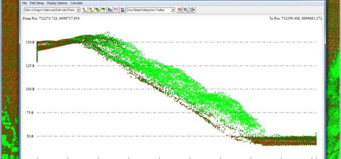
Global Mapper v17.1 LiDAR Module Now Available
Global Mapper v17.1 LiDAR Module Now Available With the New Custom Feature Extraction Tool Blue Marble Geographics is pleased to announce the immediate availability of an upgrade to the Global
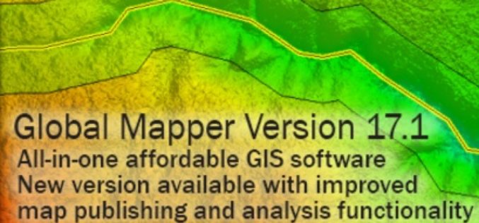
Global Mapper 17.1 Released with Improvements to Map Publishing and Analysis Tools
Hallowell, Maine – February 2, 2016 – Blue Marble Geographics (bluemarblegeo.com) is pleased to announce the availability of Global Mapper version 17.1. This intermediate upgrade to the version 17 release

Blue Marble Webinar: Working with Vector Data in Global Mapper
In mapping technology, vector data takes the form of points, lines, or polygons, with each variant distinguished by the geometric relationship of a series of x and y (and sometimes

Applied Geodesy & Geographic Calculator Public Training
Applied Geodesy & Geographic Calculator Public Training This one day session covers the foundations and principles of Geodesy and mapping. Whether you’re an expert in GIS or just starting out,
Webinar: Raster Processing In Global Mapper
Raster Processing In Global Mapper November 19, 2015 No Registration Required In many GIS processes and procedures, raster data serves as a static base map or reference layer upon which
