
Tag "Geographic Information System"

Chandigarh Begins UAV Based Aerial Survey of Properties
According to the recent news by The Indian Express, Chandigarh has become the first city in the country to conduct an aerial survey of properties using drones. The Chandigarh administration

BLM, USGS Publish Data and Visualization Site for Sagebrush Geospatial Data
The Bureau of Land Management and the U.S. Geological Survey have published a hub to enable easy visualization and access to geospatial data about the west’s “sagebrush sea.” This will help

Report on Global GIS Market: Developments and Competitive Analysis
Geographic information systems (GIS) have become a research and management tool for many professionals. Since the time GIS was first introduced in the 1960s, it has gone through many changes

Geospatial Technology to Achieve 11th Malaysia Plan
Geospatial technology will play a crucial role in helping agencies achieve the goals set out in the 11th Malaysia Plan (RMK11), according to a panel of Malaysia’s most influential industry
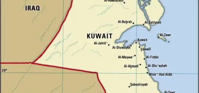
Kuwait to Use GIS for Monitoring Violations by Factories
According to recent news reported by Kuwait News Agency (KUNA) – The Public Authority for Industry (PAI) stressed the importance of the satellite-connected Geographic Information System (GIS) which aims at securing

Esri and Leica Partner to Offer Grants to Governments
Smart Communities Innovation Challenge Provides Support for Improving Mobile Government Redlands, California—Geographic information system (GIS) provider Esri has partnered with Swiss-based spatial measurement instrument manufacturer Leica Geosystems to encourage innovation

Egypt to Map Archaeological Sites
A map of all of Egypt’s archaeological sites and museums has been created and will be launched for the first time on sites around the country The Geographic Information System

Singapore Housing & Development Board Leverages Geospatial Technology for Land Use Planning
Since land-use planning is vital in a land-scarce Singapore, the republic’s Housing & Development Board (HDB) has leveraged Geographic Information System (GIS) technology in its Integrated Planning and Analysis system

GIS Market in BRIC Nations at a CAGR Of 11.13% Between 2016-2020
According to a report published by Technavio, the use of GIS technology in forest fire management, flood management, and carbon management has made the technology an effective tool in disaster management across

Singapore Land Authority 3D Smart Nation Map Debuts on the World Stage
The Singapore Land Authority (SLA) has revealed the highly anticipated first phase of its national 3D mapping project to an audience of more than 16,500 of the world’s leading geospatial
