
Tag "Geodesy"

Taiwan and Indonesia Signed Pact on Cooperation in Geodesy and Geomatics
According to recent news reported by the Taiwan News, Taiwan and Indonesia have signed a pact on Dec. 20 to foster cooperation in geodesy and geomatics, the scientific fields concerned with

Bulgaria and Macedonia Agreed to Exchange Cartographic and Geodetic Data
According to recent news reported by novini.com, the Republic of Bulgaria and Republic of Macedonia have agreed to exchange geodetic, cartographic, and cadastral data. The Memorandum of Cooperation (MoC) was signed on November 23, 2017, for

INTERGEO – Bridge to a Digital Future
Karlsruhe/Berlin, 24, July 2017 | When Geo IT experts from the worlds of business and science sat down together at a roundtable for INTERGEO and got talking, they put together
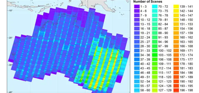
New Open-source Software Enhances Satellite Geodesy Capability
Scientists from Geoscience Australia have released new software that will improve the ability to process big remotely-sensed satellite datasets. The new “PyRate” software being presented this week at the European

NASA Awards Very Long Baseline Interferometry Support Services
GREENBELT, Md., March 30, 2017 /PRNewswire-USNewswire/ — NASA has awarded the follow-on contract for Very Long Baseline Interferometry (VLBI) Support Services to NVI, Inc., of Greenbelt, Maryland. This is a
UN-GGIM: Europe Announces Creation of GRF-Europe
New Working Group to coordinate Europe’s contribution to Global Geodetic Reference Frame Europe is contributing to the UN’s Global Geodetic Reference Frame (GGRF) by developing a platform for exchanging information
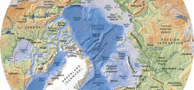
Federal Agency for Geodesy and Cartography Commissioned New Project to Compile New Arctic Atlas
The Federal Agency for Geodesy and Cartography commissioned a project to compile and publish a national atlas of the Russian Arctic, according to a RIA Novosti report. The entire project was estimated at 80 million
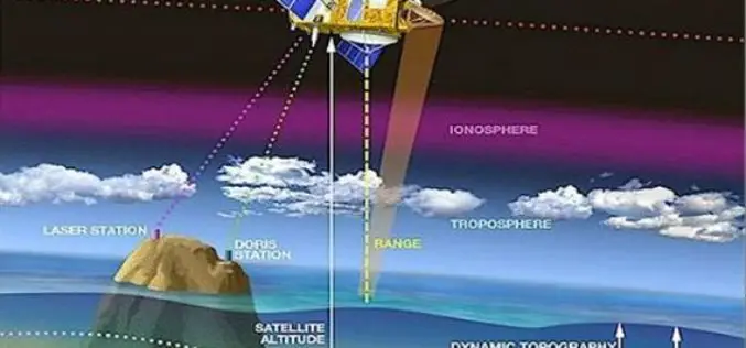
Webinar: NASA Space Geodesy Data for Precise Orbit Determination of Altimeter Satellites
Webinar: NASA Space Geodesy Data for Precise Orbit Determination of Altimeter Satellites Wednesday, June 29, 2016 at 2:00PM EDT (UTC/GMT-4) Over the last 25 years, ocean radar altimeter satellites have
INTERGEO 2016 – Conference Programme Online
Karlsruhe, 16June 2016|“The topics being covered are as diverse as the geo community itself,” says Professor Karl-Friedrich Thöne, President of the DVW, describing the INTERGEO conference programme, which has just
INTERGEO 2016 – Key Topic: Smart City
Karlsruhe, 3 May 2016 | By taking “Smart City” as a key topic, INTERGEO 2016 is focussing on a multi-faceted issue that will shape the future. The preview of the
