
Tag "Flood"
Keeping Up with the Times: Applying GIS Tools for Flood Disaster Mitigation
GIS is a powerful resource as it is accessible, free, and relevant for multiple stakeholders. Anyone can use GIS software to develop flood disaster mitigation strategies and avoid high-cost, flood-related damages on their property.
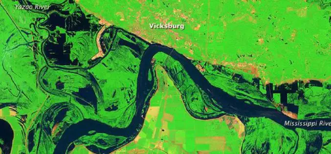
Open Source Satellite Images in Flood Monitoring. Do We Need a Liberal Spatial Data Policy During Disasters…?
Contributed by: The predictions of the meteorological department regarding the onset of natural disasters and the actual incidences of natural calamities were failed to converge in most of the situations

Bluesky LiDAR Data Used by RPS to Assess Flood Risk for Anglian Water
November 1, 2017 – A sewer flood risk map of the Anglian Water region is being created by the Wastewater Consultancy team of RPS. The highly accurate 3D digital map
Storm Water Modeling and Flood Disaster Management Using Open Source Software
Contributed by: Geospatial data serves as an input in hydraulic simulation software and thereby the simulated results can further be transferred back to GIS system for real-world graphical representation of

AIR Worldwide Expands Its Inland Flood Modeling Capabilities to Japan
Release of Touchstone Version 5.1 includes new geospatial features BOSTON, Oct. 23, 2017 — Catastrophe modeling firm AIR Worldwide has introduced a new inland flood model for Japan along with
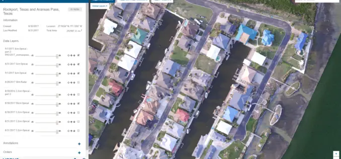
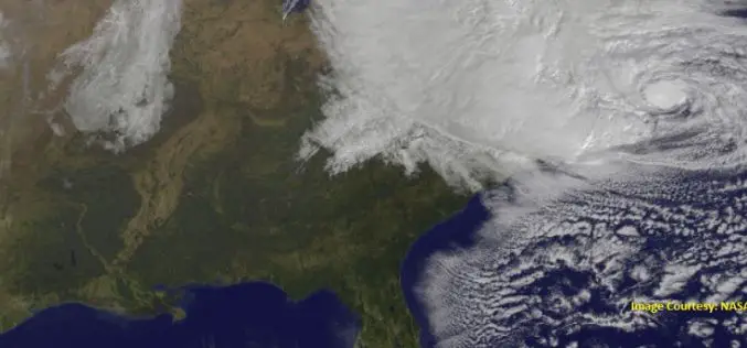
New Airbus Aerial Technology Impacts Hurricane Irma Recovery Efforts
September 12, 2017 – As residents and insurers in the southeastern United States begin to consider recovery efforts following Hurricane Irma, Airbus Aerial is prepared to help by providing insurance
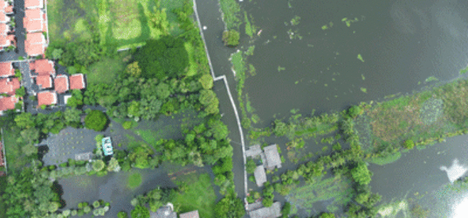
Tamil Nadu Government Started UAV Survey to Map Flood-Prone Areas
According to recent news by The Hindu, the Tamil Nadu Government in association with Anna University has launched an Unmanned Aerial Vehicle (UAV) for Photogrammetric mapping of water resources in Cuddalore

Flood Monitoring using SCATSAT-1 Satellite
Monsoon was active over different regions of India especially in Gujarat, Eastern Uttar Pradesh, Western Bihar, Assam and lately in West Bengal during mid July 2017. Heavy rains have created

2nd Edition of GIS Resources Magazine: Smart Mapping Technologies for Smart Cities – Download it Now!
Thanks for your interest and downloading GIS Resources second edition. Subscribe our mailing list to keep updated of developments in the Geospatial domain. Click to Download Second Edition – Smart
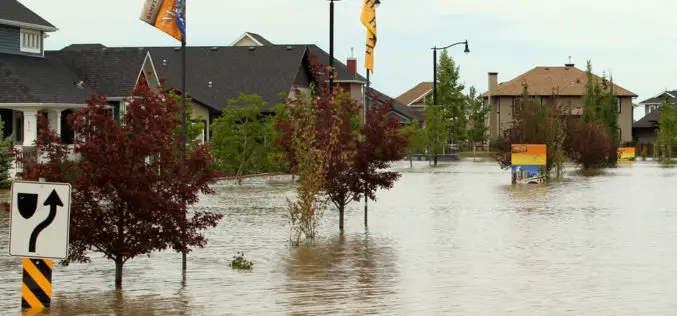
GIS & Decision Support Scenarios to Mitigate the Impact of Urban Flooding
A short spell of rain is enough to create chaos on roads in most urban areas in cities. Assurances by local authorities about preparedness to meet exigencies arising
