
Tag "Flood Monitoring"
Open Source Satellite Images in Flood Monitoring. Do We Need a Liberal Spatial Data Policy During Disasters…?
Contributed by: The predictions of the meteorological department regarding the onset of natural disasters and the actual incidences of natural calamities were failed to converge in most of the situations

Flood Monitoring using SCATSAT-1 Satellite
Monsoon was active over different regions of India especially in Gujarat, Eastern Uttar Pradesh, Western Bihar, Assam and lately in West Bengal during mid July 2017. Heavy rains have created

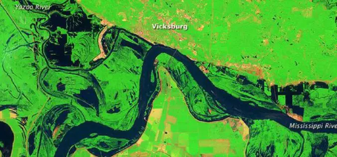
Advanced Webinar on Using NASA Remote Sensing for Flood Monitoring and Management
Advanced Webinar on Using NASA Remote Sensing for Flood Monitoring and Management When: 03/16/2016 to 04/06/2016 Times: 8:00 a.m. – 9:00 a.m. EDT (UTC-4) and 4:00 – 5:00 p.m. EDT (UTC-4)
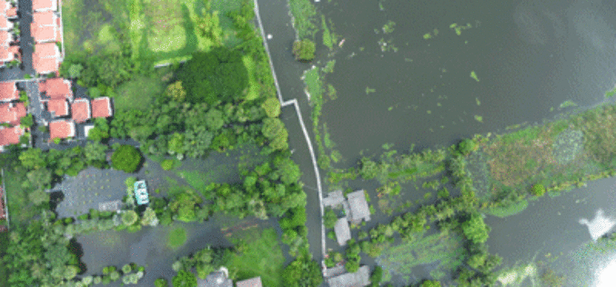
Malaysia to Use UAV to Monitor Floods
The Malaysian government will be using its newly built UAV to monitor floods during the monsoon seasons. The unmanned aircraft “Unmanned Aerial Vehicle-Remote Sensing (UV-RS)”, was collaboratively developed by ARSM, Multimedia
NASA Training on Remote Sensing Observations for Flood Management
The goal of the NASA Applied Remote Sensing Training (ARSET) is to increase the utility of NASA earth science and model data for policy makers, regulatory agencies, and other applied
