
Tag "Facebook"
GIS
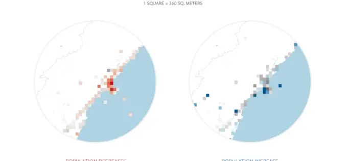
Facebook Launches Disaster Maps to Help Communities Recover and Rebuild
According to recent news by the Facebook Newsroom, Facebook is introducing disaster maps that use aggregated, de-identified Facebook data to help organizations address the critical gap in the information they often
Software
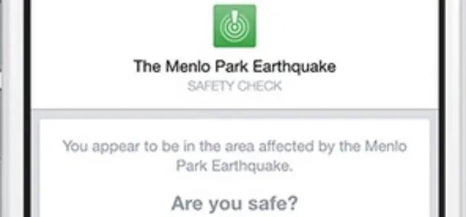
Facebook Debuts Location Based Safety Check Tool
In times of disaster or crisis, people turn to Facebook to check on loved ones and get updates. It is in these moments that communication is most critical

Software
Dubai Municipality Launches Makani an e-map App for Smart Phones
Geographic Information Systems Department of Dubai Municipality has released Makani, an e-map application for iPhone and Android phones. To make Makani a user-friendly for the residents of Dubai, the app is
