
Tag "Earth imagery"
DigitalGlobe Adds New, Innovative Partners to Its Rapidly Growing Geospatial Big Data Ecosystem
WESTMINSTER, Colo.–(BUSINESS WIRE)–Feb. 7, 2017– DigitalGlobe, Inc. (NYSE: DGI), the global leader in Earth imagery and information about our changing planet, announced the growth of its ecosystem of content producers
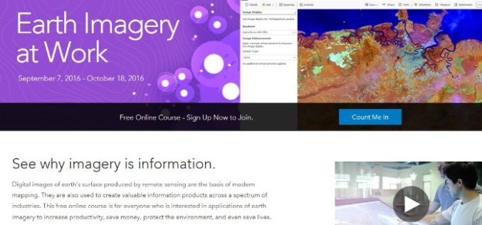
Register Now For Esri MOOC Program: Earth Imagery at Work
Earth Imagery at Work February 1, 2017 – March 14, 2017 Digital images of earth’s surface produced by remote sensing are the basis of modern mapping. They are also used to
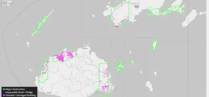
DigitalGlobe Providing Rapid Assessment of Cyclone Damage for Government of Fiji
WESTMINSTER, Colo.–(BUSINESS WIRE)–Mar. 7, 2016– DigitalGlobe, Inc. (NYSE: DGI), the global leader in earth imagery and information about our changing planet, is delivering crowdsourced damage assessments derived from satellite imagery

Saab and DigitalGlobe Announce Vricon Joint Venture to Create the Globe in 3D
Vricon will create high resolution elevation products and accurate, immersive 3D products with unmatched coverage and delivery timelines Defense and security company Saab and DigitalGlobe, Inc. (NYSE:DGI), a leading global
