
Tag "Drone"
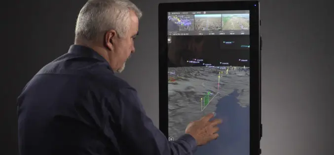
Kongsberg Geospatial & AirMap Deliver Real-Time Airspace Awareness and Tools for Drone Flight Beyond Visual Line of Sight
Ottawa, CA: Kongsberg Geospatial, an Ottawa-based developer of real-time, mission critical, geospatial visualisation software, and AirMap, the leading airspace management platform for drones, announced today that they will be delivering
PrecisionHawk Brings Its Drone Data Platform to Australia
The launch of a Sydney office and partnership with agricultural powerhouse Ruralco, brings PrecisionHawk’s drone and data packages close to home for growers and businesses to get started with the

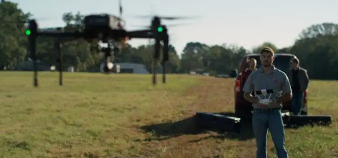
PrecisionHawk Webinar: Can Drones Really Be a Game Changer for Agriculture?
Can Drones Really Be a Game Changer for Agriculture? Thursday, October 27th | 1-2 PM Central Time You hear a lot about how drones will change the future of farming… but how

senseFly to Unveil New RTK/PPK-Ready, Large Coverage Mapping Drone at INTERGEO 2016
New eBee Plus system includes: long-flying fixed-wing airframe; photogrammetry-optimised RGB sensor; next-gen flight & data management software senseFly, the world’s first choice producer of professional mapping drones, will introduce its
senseFly and Maptek Sign Agreement Around Data Collection and Analysis Solution
Swiss professional drone maker, senseFly, has recently signed an agreement with Maptek, experts in precision measurement and visualisation for the mining industry, that enables Maptek to offer its customers a
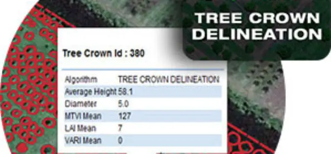
Tree Crown Delineation a New App to Monitor Trees
The latest drone app, Tree Crown Delineation automatically identifies individual tree crowns in your aerial survey. It also generates a geospatial layer of tree crowns with overall health level and
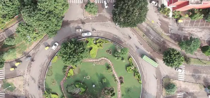
Chandigarh Begins UAV Based Aerial Survey of Properties
According to the recent news by The Indian Express, Chandigarh has become the first city in the country to conduct an aerial survey of properties using drones. The Chandigarh administration
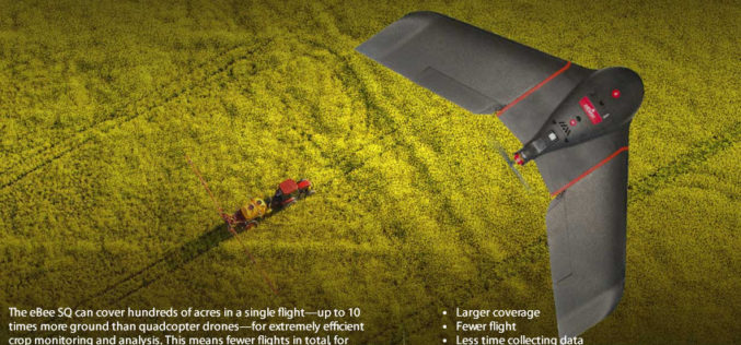
senseFly Ups The Agricultural Ante With Launch Of High Precision, Large Coverage eBee SQ Drone
This new drone is built for the Parrot Sequoia multispectral camera and can cover up to 10 times more ground than small quadcopter systems Cheseaux, Switzerland, August 31 — Swiss
PrecisionHawk and Skyward Partner to Provide Full-Service Drone Platform to Commercial Customers
PrecisionHawk’s leading UAVs, data mapping and analysis software and LATAS safety platform will be connected to Skyward’s operations management platform to provide a holistic drone workflow for the commercial market

Get Ready for the New Small Drone Rule!
A new world of opportunities for drone operators opens next week on August 29 when the new small drone rule for non-hobbyists becomes effective. The Federal Aviation Administration (FAA) wants
