
Tag "Disaster Management"
HARRIS Geospatial Solutions Webinar: The Applications and Benefits of Synthetic Aperture Radar (SAR)
Synthetic Aperture Radar (SAR) is rapidly becoming a key dataset in geospatial investigation. Unlike many other observational methods, SAR is not limited by illumination or cloud cover. In recent years,

UAV can be Effectively Used in Disaster Management: NDMA
New Delhi, Nov 7, 2017 (PTI) – Unmanned aerial vehicles (UAVs) can be effectively used in disaster management, the National Disaster Management Authority (NDMA) today said. “UAVs can provide high-resolution,

Disaster Management Authorities to Get a New Tool to Handle Tsunamis
According to recent news by the First Post, Disaster management authorities are all set to get a new tool to handle tsunamis. They will be able to know how far the
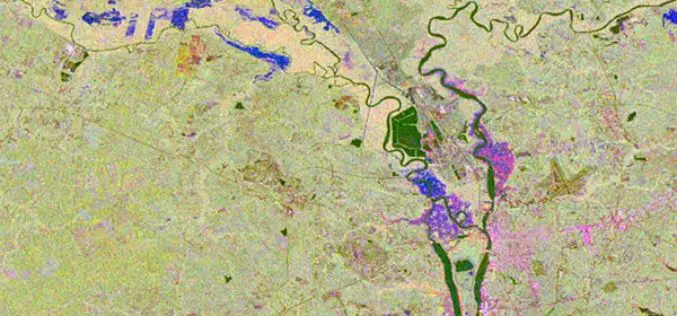
Storm Water Modeling and Flood Disaster Management Using Open Source Software
Contributed by: Geospatial data serves as an input in hydraulic simulation software and thereby the simulated results can further be transferred back to GIS system for real-world graphical representation of

Skymet Tackles Perils of Agriculture Climate Change
Skymet is India’s foremost private and largest weather monitoring and agriculture risk Solutions Company, expert in measuring, predicting and limiting climate risk in agriculture, disaster management and energy. Over the

NDMA Holds Meeting on Landslide Risk Management Strategy
ANI – The National Disaster Management Authority (NDMA) today called on a meeting to discuss the formulation of a National Landslide Risk Management Strategy. This was the first meeting of

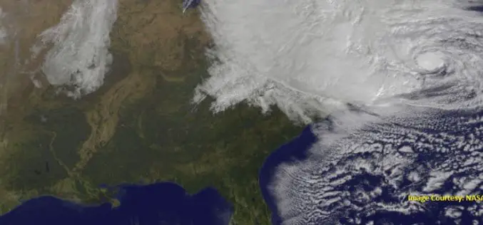
Fifteen Years of Disaster Relief From Space – Global Patterns and Trends
14 July 2016 – Today, the analysis and use of satellite images is commonplace. Just 15 years ago, however, only a handful of specialists worked with these valuable data. Since then,

Indonesia Using Geoportal to Monitor the Condition of Public Infrastructure
The Ministry of Public Works and Public Housing’s Institute of Road Engineering, Agency for Research and Development (Pusjatan) has unveiled a new smart mapping portal called Geoportal Pusjatan, which was

NASA ARSET Training: Using NASA Remote Sensing for Disaster Management
NASA ARSET Training: Using NASA Remote Sensing for Disaster Management 06/09/2016 to 06/30/2016 Times: 11:00 a.m.-12:00 p.m. and 6:00-7:00 p.m. EDT (UTC-4) NASA remote sensing and modeling resources are useful for

Tweets Can Help Speed Up Disaster Management
New York – Leveraging publicly available tweets or other social media posts could help disaster response agencies quickly identify impacted areas in need of assistance, says a new study. By
