
Tag "Digital imaging"
Remote Sensing
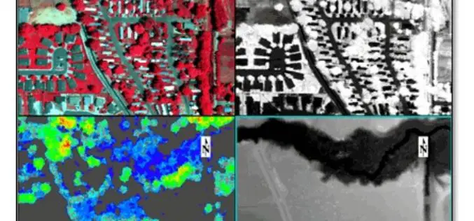
LiDAR and Hyperspectral Data Fusion
We all in the geospatial domain have heard about data fusion/image fusion, a technique or way of combining the spectral information of a coarse-resolution image with the spatial resolution of
Remote Sensing
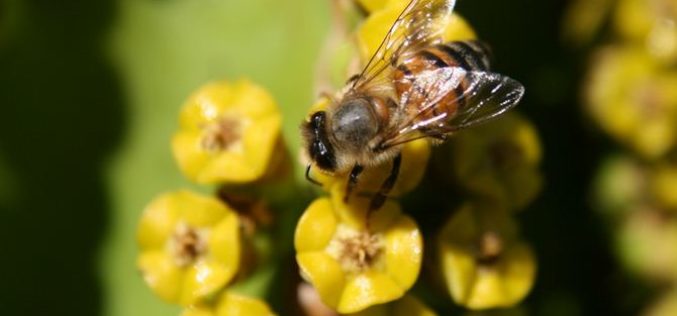
Remote Sensing Technology to Map Flowering Plants
Researchers from Finland, Kenya, South Africa and Sudan have created a flowering map for a semi-arid Savannah site in Africa using a new remote sensing technology. The remote sensing technology combines
