
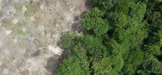
Tag "Deforestation"
Webinars
HARRIS Geospatial Solutions Webinar: The Applications and Benefits of Synthetic Aperture Radar (SAR)
Synthetic Aperture Radar (SAR) is rapidly becoming a key dataset in geospatial investigation. Unlike many other observational methods, SAR is not limited by illumination or cloud cover. In recent years,

LiDAR
Open Source Software for Bulk LiDAR Data Processing Released
Developed for Forest Carbon Monitoring to Support Reducing Emissions from Deforestation and Forest Degradation (REDD+) in Kalimantan, Indonesia; Now Available for Public Use. For this project, Applied GeoSolutions and the
Remote Sensing
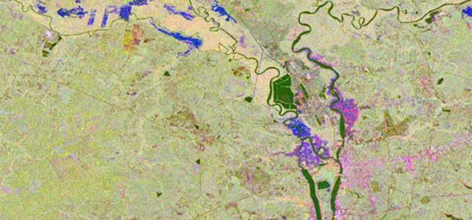
Radar Satellite Data for Mapping Dynamics of Deforestation and Forest Degradation
Have you ever think about the importance of forests in our daily lives of concrete jungles? Forests products are used in our daily lives. All activities directly or indirectly involve
Videos
Earth from Space: Adeus, Amazon Rainforest Deforestation
24 years of Amazon Rainforest deforestation in the Brazilian state of Rondônia are shown in a simulated animation. Source: ESA
