
Tag "ArcPad alternative"
Brandenburg Forest Office, Germany, Select SuperSurv for Forest Conservation
Supergeo Technologies, the leading GIS software and solution provider, announces that Brandenburg Forest Office (Landesbetrieb Forest Brandenburg), Germany has adopted the smart mobile GIS app—SuperSurv to investigate the forest conservation

SuperPad Reveals NTRIP Solution to Achieve Centimeter Level Accuracy
Supergeo, the leading GIS software and solution provider, is going to release NTRIP solution on its Windows Mobile GIS app, SuperPad, for high accurate field data collection and geospatial workflow

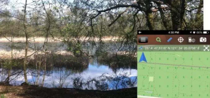
iOS Mapping Solution, SuperSurv, Enhances Raster Data Support
Supergeo releases the latest update of SuperSurv 3.2 (iOS) to enhance the functionality and efficiency for mobile GIS surveyors. Having stronger compatibility with raster dataset and convenient tools for data
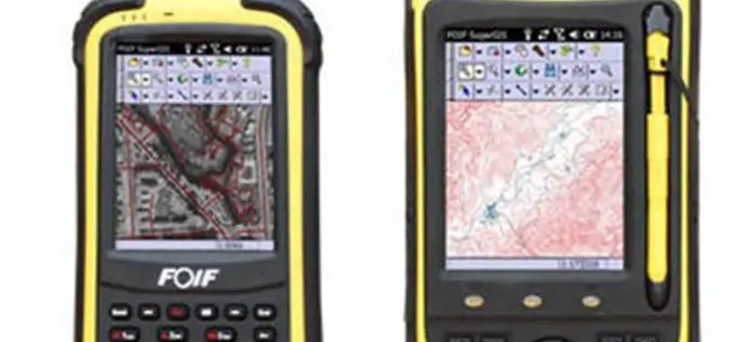
High Accuracy GIS Total Solution by FOIF SuperGIS
Supergeo Technologies, the global leading GIS software and solution provider, announced the cooperation with Suzhou FOIF Co. (FOIF) in providing worldwide surveyors with high accuracy GIS turnkey solution. Mobile GIS

SuperSurv Elevates Tequila Industry Development in Mexico
Supergeo Technologies, the global leading GIS software and solution provider, announce that Consejo Regulardor del Tequila (CRT), A. C., Mexico, utilizes SuperSurv to strengthen blue agave management and tequila quality.
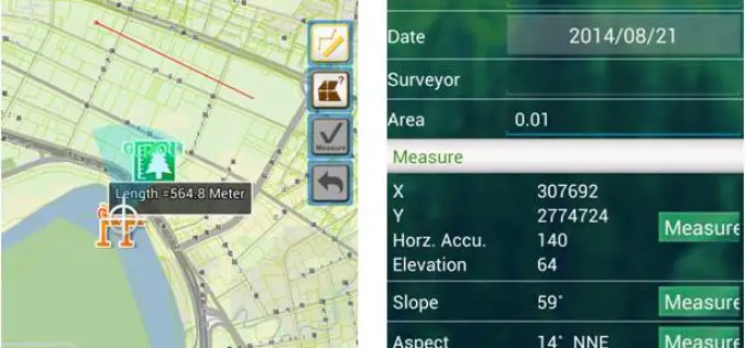
Supergeo to Release Forest Inventory App for Android Users
Forest Inventory App, an Android app designed for forest information collection, developed by Supergeo, will be released to provide forest investigators with a professional and handy tool for field survey
