
Tag "3D Geodata"
Business
Vricon Launches Newest, Disruptive Geospatial Product: Digital Terrain Model
McLean, VA – Vricon unveils the newest product in the Vricon Data Suite: the 0.5m resolution Digital Terrain Model (DTM), a high-resolution bare earth elevation data layer. Vricon produces its

Business
Vricon Joins Esri Partner Network to Expand Use of High-Resolution 3D Geodata
Redlands, California—Vricon, a leading provider of photo-realistic 3D mapping products and digital elevation models for the defense and security industries, is now a member of the Esri Partner Network. Vricon’s

Business
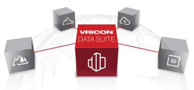
Vricon Data Suite: Putting Earth in Customers’ Hands
7 January 2016 — Today, Vricon unveils its Data Suite that includes the Vricon 3D Surface Model, Vricon DSM, Vricon Point Cloud, and Vricon True Ortho. All four products are
