
Tag "3D Elevation Program"

Highest Peak in North America to be Surveyed
Several agency partners plan to update the height of Mount McKinley this summer A new GPS survey of Mount McKinley, the highest point in North America, will update the commonly
State and Regional 3DEP Stakeholder Workshops Underway
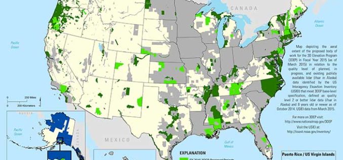
The U.S. Geological Survey National Geospatial Program is developing the 3D Elevation Program (3DEP) to respond to growing needs for high-quality topographic data and for a wide range of other
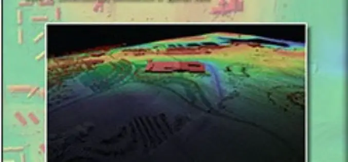
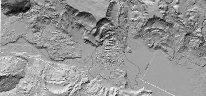
USGS Lidar Base Specification Version 1.2
The US Geological Survey National Geospatial Program is pleased to announce a new version of the USGS Lidar Base Specification that defines deliverables for nationally consistent lidar data acquisitions. The USGS Lidar
Meeting the Elevation Needs of the Nation
Nearly 25 state-specific fact sheets are now available to understand 3DEP applications Want to know how elevation will benefit your state? The USGS National Geospatial Program is advancing the 3D Elevation Program,
