 Developed by Supergeo Technologies, SuperGIS 3D Earth Server is going to support underground utilities management. The breakthrough tech enables administrators to comprehend the distribution of underground utilities that cannot be seen in daily life and to arrange urban plans and make policies and decisions with full-scale perspective.
The underground pipelines, usually distributed near to the places with crowded population, are rarely seen by the public but extremely important, as emergencies cause drastic impact. The management of underground pipeline utilities becomes a great part of urban development and disaster-prevention management.
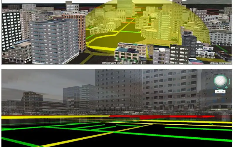
SuperGIS 3D Earth Server provides the ability to visualize and manage underground utilities. Users can observe the complicated pipelines through an underground view to better understand pipelines’ distribution and to cross refer to the information of buildings and traffic on the surface for urban development and preservation.
In addition to the underground view, SuperGIS 3D Earth Server also supports users to create a profile of the underground utilities; therefore, the pipeline managers can know the relations among the excavation position and vertical distribution of other pipelines, and the complete information of the underground utilities will be provided for roadway maintenance to reduce test time.
Moreover, SuperGIS 3D Earth Server supports to show and highlight the pipeline information on the 3D map (such as year, administrative departments, and so forth) by clicking the pipeline on the interface of the profile view.
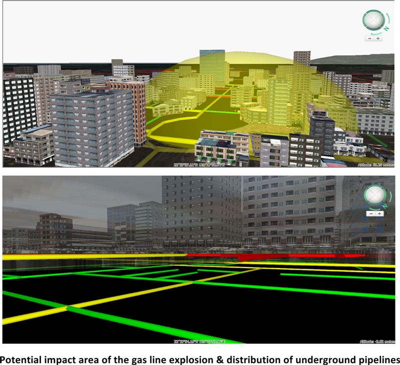
Administrators can benefit a lot and completely comprehend the impact of underground pipeline from the 3D display and full-scaled view of pipelines. For example, the potential impact area of the gas line explosion at a specific location can be seen clearly on the 3D map; hence, as long as a gas leak event is detected, the authorities can quickly find out the impact area and evacuate the residents to reduce the damage.
With SuperGIS 3D Earth Server, administrators can see what distributed underground and cannot be seen on the surface, and monitor and manage them with the powerful system, smoothing the development and preservation of underground utilities and improving the safety of people’s lives and properties.
# # #
About Supergeo
Supergeo Technologies Inc. is a leading global provider of GIS software and solutions. Since the establishment, Supergeo has been dedicated to providing state-of-the-art geospatial technologies and comprehensive services for customers around the world. It is our vision to help users utilize geospatial technologies to create a better world.
Supergeo software and applications have been spread over the world to be the backbone of the world’s mapping and spatial analysis. Supergeo is the professional GIS vendor, providing GIS-related users with complete GIS solutions for desktop, mobile, server, and Internet platforms.
Marketing Contact:
Patty Chen
Supergeo Technologies Inc.
5F, No. 71, Sec. 1, Zhouzi St., Taipei, 114, Taiwan
TEL:+886-2-2659 1899
Website: http://www.supergeotek.com
Email: patty@supergeotek.com