Satellite Remote Sensing of Particulate Matter Air Quality: Data, Tools, Methods and Applications

Satellite Remote Sensing of Particulate Matter Air Quality: Data, Tools, Methods and Applications (aka AOD-PM)
October 1 – October 29, 2015
5 webinars: one hour per week
Every Thursday 11:30 AM (EDT) Eastern Daylight Time
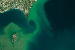
 Satellite remote sensing of particulate matter for air quality applications has advanced over the past decade. Many methods, data, and tools have been developed by various groups around the world to convert satellite retrieved aerosol properties into surface level particulate matter mass concentrations for air quality monitoring. Data from several satellites are currently being used for a wide range of air quality applications for both research and operational purposes.
Prerequisite: Due to the advanced nature of this webinar, we strongly encourage participants to review the following topics:
1) basics of satellite remote sensing of aerosols
2) basics of ground based aerosol measurement techniques (remote sensing and in-situ).
If you have not participated in an ARSET air quality training in the past, then we strongly encourage that you carefully review the materials and recordings from previous ARSET webinars. Review materials are available from the following link:
Registration: This webinar is free but you must register at the link shown below. Space is limited and preference will be given to agencies engaged in air quality monitoring, management and decision making around the world. You will be notified by email if your registration has been approved before/by September 15, 2015.
Register here: https://arset.
adobeconnect.com/pm–aq/event/ registration.html
For more information, please see the training webpage here: http://arset.gsfc.nasa.