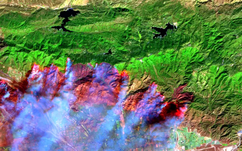
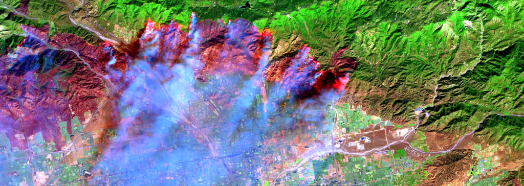
 In recent news, recent satellite image analysis of Bandipur and Nagarahole National Parks reveals that nearly 2,500 hectares of forest has been lost in a forest fire began over a week ago on March 13.
Satellite image analysis by National Remote Sensing Satellite (NRSC) of MODIS Terra satellite and AWiFs (Advance Wide Field Sensor) of RESOURCESAT 1 and RESOURCESAT 2 has been done to detect active fire spots and to delineate forest burn area. The images have been uploaded on ISRO’s geo-portal ‘Bhuvan’.
Principal Chief Conservator of Forests (Wildlife) Vinay Luthra told The Hindu:
Ground truthing’ through global positioning system (GPS) tracking was necessary to corroborate NRSC’s analysis. Barring several bamboo clumps that went up in flames, the fire was essentially a “ground fire” and not a “canopy fire”.
But Forest Department estimates damage to 620 hectares
Source: The Hindu