PrecisionHawk Acquires Droners.io and AirVid to Launch the Nation’s Largest Network of Commercially Licensed Drone Pilots
PrecisionHawk will merge the two companies under the Droners.io name and platform to support the delivery of on-demand, drone-based imagery to its enterprise clients
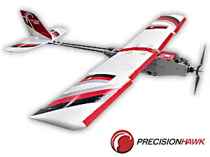 Raleigh, NC – February 8, 2018 – PrecisionHawk Inc. – a leading provider of drone technology for the enterprise –today announced the acquisition of Droners.io and AirVid. Both platforms enable users to commission drone pilots for commercial jobs. PrecisionHawk will merge the companies to form a network of more than 15,000 commercially licensed drone pilots – making it the largest of its kind. The company will continue to connect certified drone pilots directly to customers. In addition, PrecisionHawk will use the network to service its growing base of enterprise customers in insurance, agriculture, energy, construction and government.
Since the Federal Aviation Administration began allowing corporations to use drones for commercial purposes in 2016, PrecisionHawk has fielded increasing demand for drone flight services from the business and government sectors. A network of professional drone operators will allow the company to quickly scale its team and technology to meet the growing demand for timely and consistent aerial data collection.
“Droners.io and AirVid share our mission of helping drone operators turn their passion into a profession,” said Michael Chasen, PrecisionHawk CEO. “Combined with PrecisionHawk’s expertise in providing professional drone services to the enterprise, this merger enables us to build the best platform for drone pilots while simultaneously providing our enterprise clients with the on-demand services they require.”
By the end of 2018, PrecisionHawk expects to have fulfilled hundreds of thousands of missions. To meet this demand, the company will focus on growing its newly formed network of certified pilots nation-wide and abroad. Part 107 certified pilots can join the network and start accepting jobs in their region by creating a profile at www.droners.io.
Dave Brown, who founded Droners.io, will manage the pilot network development team. Patrick Egan, founder of AirVid, will assist PrecisionHawk as a consultant.
“We believe that a drone pilot network is one of the fundamental building blocks of a successful drone ecosystem,” said Dave Brown. “We’re excited to continue our mission with PrecisionHawk and support the growth of the drone pilot economy.”
The announcement comes just two weeks after the PrecisionHawk closed $75 million in Series D funding. Both the funding and the pilot network merger are in service of the company’s mission to foster global adoption of commercial drone technology.
About PrecisionHawk
PrecisionHawk is a leading provider of drone technology for the enterprise. PrecisionHawk’s client list includes Fortune 500 companies and market leaders in 150 countries, spanning a range of industries, including agriculture, energy, insurance, government and construction. To date, PrecisionHawk has raised more than $100 million from leading venture capital firms including Third Point Ventures and Millennium Technology Value Partners, with strategic investments from enterprise customers and partners including Comcast Ventures, DuPont, Intel Capital, NTT Docomo, and Yamaha Motor. The company, founded in 2010, is privately held and headquartered in Raleigh, NC. More information about PrecisionHawk can be found at www.precisionhawk.com or on Twitter @PrecisionHawk.
PrecisionHawk Contact:
Lia Reich, VP Marketing-Communications | press@precisionhawk.com