The Penn State Cooperative Extension Land Analysis Lab has developed PAOneStop, an online tool for farmers. PAOneStop provides online tools to help farmers meet regulatory requirements for Conservation and Nutrient Management Planning. Development of PAOneStop is ongoing and will be released to the public incrementally.
The interface was created to help Pennsylvania farmers reduce the environmental impact their farms were having on the Chesapeake Bay and other water-based ecosystems. Pennsylvania farmers can use PAOneStop to map fields and reduce soil erosion.
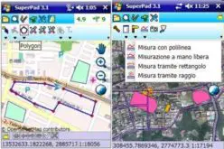
PAOneStop simple tool for farmers to create farm planning maps easily and inexpensively; the PAOneStop Nutrient Management Planning Mapping Module provides this tool through a simple, online interface.

The first module of PAOneStop is a Nutrient Management Mapping Module. This module provides a tool to extract data and generate high quality maps that are required for completion of Nutrient Balance Sheets and Nutrient Management Plans. Methods to develop Nutrient Management Plans and Balance Sheets are available to farmers but require farm planning maps as part of the process. Maps can be a challenge to produce and are expected to contain features such as field boundaries, acreages, stream and water features, wells, sinkholes, application setbacks and buffers, soils, aerial images and more.
The second module within PAOneStop, and currently under development, will provide tools to assist farmers in developing Conservation Plans (erosion and sedimentation, E&S) to meet regulatory requirements, reduce soil loss, and protect the water quality.
PAOneStop has many benefits to you, free to all users!
- Generate high-quality maps on aerial imagery.
- No specialized software needed.
- Farm information can be saved online for future edits & use.
- Farm only needs to be drawn once.
- Field acreages automatically calculated.
- Helps meet regulatory requirements design to protect PA water resources.
- Easy production of high-quality farm maps.
- Air photo and topographic imagery provided
- Digital or hard copy maps produced.
- Individual farm information secured.
- Extract NRCS soils data for individual fields.
PAOneStop is optimized for Mozilla Firefox.
Begin Mapping Now