Ordnance Survey (OS) has signed a deal with the Sultanate of Oman Ministry of Defence to help the National Survey Authority (NSA) advance its position as Oman’s national mapping authority.
 This contribution to the development of NSA as a world-class national mapping authority is the start of a long-term strategically-important relationship between Oman and OS, as digital mapping and location data increasingly underpins Oman’s digital economy and Government.
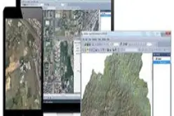
The deal will see OS International (OSI) assisting Oman’s NSA with the creation of a new online geospatial manual. Contributing to the Oman National Spatial Data Infrastructure, the manual will provide guidance to the survey and geospatial community across Oman, giving government, business and citizens the reliable, credible and authoritative geospatial information necessary for a ‘smart’ economy and society.
The OSI delivery team will work with the NSA to update existing material and draft new content for the manual, which will contain a range of documents that set the policies, standards and processes required to survey, manage and distribute mapping and information across the Sultanate. The economic value of using authoritative geospatial information, including quality address data, across the economy could be worth as much as OMR 140 million a year to the Sultanate of Oman.
OSI will also conduct a Geospatial Maturity Assessment, to help guide NSA on potential next steps in its operational development.
Air Commodore Yaqoob bin Saud Bin Said Al-Toobi, Head of National Survey Authority, and Mr. Saleem Bin Abdullah Bin Salim Al-Hashmi, Director of Geospatial Information in their joint statement, said: “It is an honor to work with OSI especially looking back on the historical relationship we have between our two organisations. It is NSA’s privilege with the support of His Excellency the Minister Responsible for Defence Affairs, Sayyid Badar Bin Saud Al-Busaidi, to be given an opportunity to interact with OSI to bring the latest technological with International Standards in establishing the first of its kind, the Oman Geospatial Manual. This will be part of the Sultanates Geospatial Infrastructure to aid National Strategic Projects as well as support to the NSDI which is being currently established by NCSI with NSA being its strategic partner.”
His Excellency the British Ambassador to Oman, Jon Wilks CMG, said: “I am delighted to see Ordnance Survey International, the global leader in mapping and a great example of UK technical excellence, developing a partnership with NSA and Oman and enabling Oman to develop world class capabilities of its own.”
John Kedar, Director of Strategic Relationships at OS, says: “Great Britain has benefitted socially and economically from our digital mapping data including comprehensive national address data. OS leads the world in this area. It’s an honour for us to be able to share our expertise and experience with Oman. We look forward to working collaboratively across all levels of our respective organisations, helping to achieve Oman’s goal of comprehensive, sustainable, development.”
NSA delivers nationwide mapping and data to Oman. It holds a range of documents that set the policies, standards and processes required to survey, manage and distribute mapping and information. However, there are gaps in this knowledge and it is not easily accessible by stakeholders. NSA intends to deliver an online Oman National Geospatial Manual to capture and set these policies, standards and processes, contributing to the Oman National Spatial Data Infrastructure.
As Britain’s mapping agency, OS underpins digital Britain by bringing location to the heart of decision making and information sharing. OS maintains the geographic database of Great Britain, which contains more than 450 million unique geographic features, making it the largest of its kind in the world. Each day OS makes over 10,000 changes a day to that database.