New Google Maps to Measure and Calculate Aerial Distances

New Google Maps to Measure and Calculate Aerial Distances
Google Maps

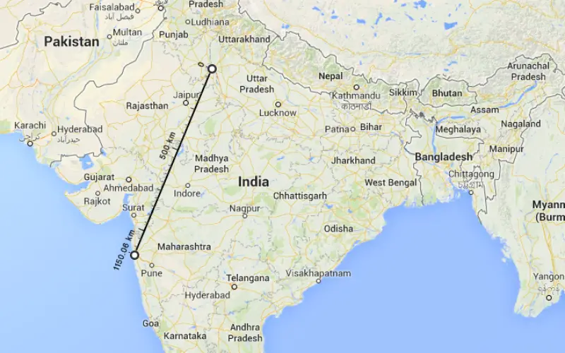
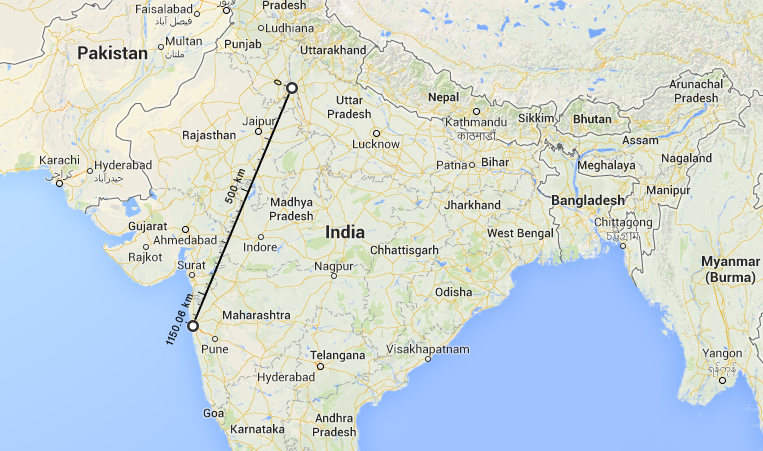
Aerial Distance Between Delhi and Mumbai = 1150.06 km (714.61 mi)

The worlds most popular mapping platform, Google Maps now features measurement of aerial distances.

To use the new tool, open Google Maps on your browser. Right click on the staring point then click Measure distance. Again right click at the destination you want to measure the distance and choose Distance to Here. And here it comes a line with scale with the total distance between starting and destination point or Look on the map and under the search box.

Its great that Google has come up with such useful application and makes handy to measure distances.

Categories: GIS

About Author

GIS Resources

GIS Resources is an initiative of Spatial Media and Services Enterprises with the purpose that everyone can enrich their knowledge and develop competitiveness. GIS Resources is a global platform, for latest and high-quality information source for the geospatial industry, brings you the latest insights into the developments in geospatial science and technology.

Comments

  1. Laxmikant Bhumkar
    Laxmikant Bhumkar 27 June, 2022, 10:09

    Thanks for this easy solution to map aerial distance!

    Reply this comment

Write a Comment

Your e-mail address will not be published.
Required fields are marked*

This site uses Akismet to reduce spam. Learn how your comment data is processed.