NASA ARSET Training: Introduction to Synthetic Aperture Radar
Introduction:
A limitation of optical satellite remote sensing is that it depends on cloudless, well-illuminated areas to produce quality data. This is especially problematic for collecting data during nighttime, around storms, and in densely-forested areas. Synthetic Aperture Radar (SAR) is a solution to many of these obstacles. SAR can observe the Earth’s surface day and night, through most weather conditions, and the signal can penetrate the vegetation canopy. There are a number of existing SAR datasets from current and past airborne and satellite missions, as well as exciting upcoming missions. This online webinar will focus on building the skills needed to acquire and understand SAR data, including polarimetric and interferometric SAR (PolSAR and InSAR), as well as potential applications.
The first broadcast of each session will be in Spanish, and the second in English. All materials and recordings will be available in both English and Spanish.
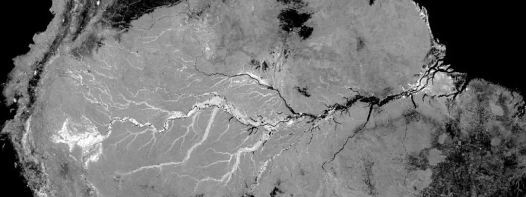
SMAP Radar Mosaic of the Amazon
Learning Objective:
By the end of the training, attendees will be able to:
- interpret the information in SAR images
- recognize distortions that need to be corrected in SAR images
- describe the basics of PolSAR and the information provided by different polarizations
- describe the basics of InSAR and the information in an interferogram
- Four one-hour sessions
- Sessions will be held Wednesday, June 28; Thursday, June 29; Wednesday, July 5; and Thursday, July 6
- Please note: these take place Wednesdays and Thursdays June 28-July 6
- Each session will be offered at 12:00 p.m. and 9:00 p.m. EDT (UTC-4)
- Please note: The 12 p.m. session will be offered in Spanish and the 9 p.m. session will be offered in English
- Convert to your local time »
- Sessions will be held Wednesday, June 28; Thursday, June 29; Wednesday, July 5; and Thursday, July 6
- A certificate of completion will be provided to participants that attend all live webinars and complete the homework assignments.
Prerequisites:
Prior to the first week, please complete the following prerequisites. Attendees that do not complete prerequisites may not be properly prepared for the pace during the training.
- Fundamentals of Remote Sensing, Session 1. View »
- Download and install QGIS (or a similar GIS software) and accompanying software
- Use this Downloading and Installing QGIS exercise for help
Register Now