MRSA Satellite Image Analysis Show New Debris Field

MRSA Satellite Image Analysis Show New Debris Field

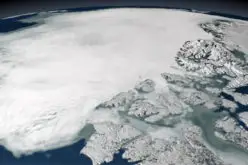
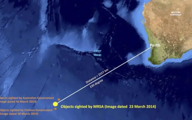
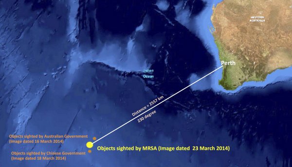
In recent news, the  images taken on March 23 by Airbus Defence and Space in France were analysed by the Malaysian Remote Sensing Agency, which was “able to identify 122 potential objects” in an area measuring 400 square kilometres, Hishammuddin Hussein says.

“Some objects were a metre in length and others were as much as 23 metres in length,” he added. “Some of the objects appear to be bright, possibly indicating solid material. The objects were located approximately 2,557 kilometres from Perth.”

MH 730

Categories: Remote Sensing

About Author

GIS Resources

GIS Resources is an initiative of Spatial Media and Services Enterprises with the purpose that everyone can enrich their knowledge and develop competitiveness. GIS Resources is a global platform, for latest and high-quality information source for the geospatial industry, brings you the latest insights into the developments in geospatial science and technology.

Write a Comment

Your e-mail address will not be published.
Required fields are marked*

This site uses Akismet to reduce spam. Learn how your comment data is processed.