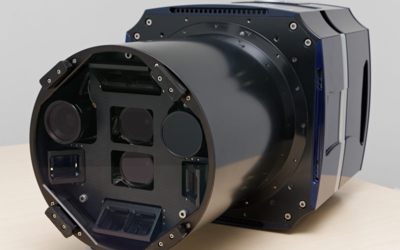
 Baltimore, Maryland — March 25, 2013 — From the ASPRS conference in Baltimore, Maryland, Microsoft’s UltraCam business unit introduces the UltraCam Osprey, a new digital aerial system that combines a high performing photogrammetric nadir camera with oblique image capture capabilities.
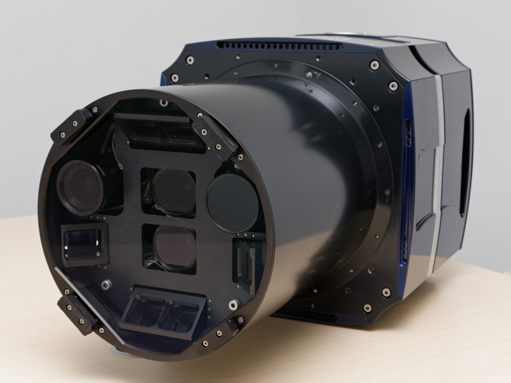
This third generation UltraCam camera builds on the UltraCam Eagle technology, including advanced electronics to achieve an exceptional signal/noise ratio; solid state storage of 3.3TB; and a modular housing concept that integrates all components into one unit. To achieve high flight efficiency, the UltraCam Osprey is designed so that the full swath width of the nadir cone (11,674 pixels) can be used, and oblique wing images overlap enough to generate oblique orthos. The 60 MP backward and forward wing images and the 32 MP left and right wing images, combined with a 2.2 second frame rate, ensure adequate coverage. Due to the overlap with the nadir part of the camera, the wing image orientation can be further improved by automated tie point matching.
The nadir camera collects five bands (PAN, RGB, NIR) with subpixel accuracy and high dynamic range equivalent to other Ultracam cameras. This dataset can be used for most photogrammetric applications, such as cadastre, infrastructure planning, and DTM or DSM ortho generation. The combined oblique and nadir imagery is appropriate for more kinds of applications than a standard oblique camera or a stand-alone photogrammetric camera. The resulting data is very useful for urban mapping and 3-dimensional city modeling.
The UltraCam Osprey is fully supported in the UltraMap workflow software system. The ability to perform aerotriangulation (AT) and dense matching allows for the creation of high accuracy point clouds, DSM, DTM, DSMorthos and DTMorthos (traditional orthos). The camera is also compatible with the UltraNav direct georeferencing and flight management system.
“The UltraCam Osprey is the beginning of a new chapter in the development of the UltraCam product line that combines multiple sensors and mature software to achieve richer datasets,” said Alexander Wiechert, Microsoft Business Director. “The versatility of the UltraCam Osprey should open up new opportunities for our customers.”
The UltraCam Osprey will be available for delivery to customers in fall 2013. Existing UltraCam customers can receive trade-in credit toward upgrading to an UltraCam Osprey at any time.
About Microsoft’s UltraCam Business Unit
With its operations based in Graz, Austria, and sales and support teams in North America, Microsoft’s UltraCam business unit brings more than two decades of photogrammetry expertise to Microsoft’s Bing Maps business unit. The division is responsible for the highly successful line of UltraCam digital aerial mapping systems that include the UltraCamLp,UltraCamXp, UltraCamXp Wide Angle, UltraCam Falcon, UltraCam Eagle and UltraCam Osprey digital photogrammetric sensors. Rounding out the UltraCam offerings is the fully integrated UltraMap workflow software system, with features that include high-density 3D point cloud creation, highly accurate and detailed digital surface model (DSM) generation, and ortho mosaicing capabilities based on an automatically generated DSM or DTM.
About Microsoft
Founded in 1975, Microsoft (Nasdaq “MSFT”) is the worldwide leader in software, services and solutions that help people and businesses realize their full potential.