Nearly 25 state-specific fact sheets are now available to understand 3DEP applications
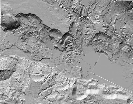
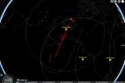
Lidar image showing the upper parts of the landslide that occurred in northwest Washington on March 22, 2014.
Want to know how elevation will benefit your state? The USGS National Geospatial Program is advancing the 3D Elevation Program, known as 3DEP, in response to the growing need for high-quality three-dimensional representations of the Nation’s natural and constructed features. 3DEP uses modern technology to systematically collect high-density light detection and ranging (lidar) elevation data over the U.S. and interferometric synthetic aperture radar (ifsar) data above Alaska where cloud cover and remote locations preclude the use of lidar for much of the State.
“Looking at lidar is like looking at the world through 3D glasses” said Kevin Gallagher, the USGS Associate Director for Core Science Systems. “Phenomena that were once obscured are suddenly fully evident in rich color and detail. As you might expect, the applications of such new and transformational data are growing rapidly, from civil engineering, precision agriculture and flood inundation modeling, to forest management, intelligent vehicle navigation and emergency response. A national dataset of such data will drive innovation, transform government and industry, and stimulate the economy.”
Elevation data are essential to a broad range of applications and support a large range of business uses including national security, wildlife and habitat management, water resource management, and geologic hazards mitigation, to name a few.
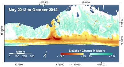
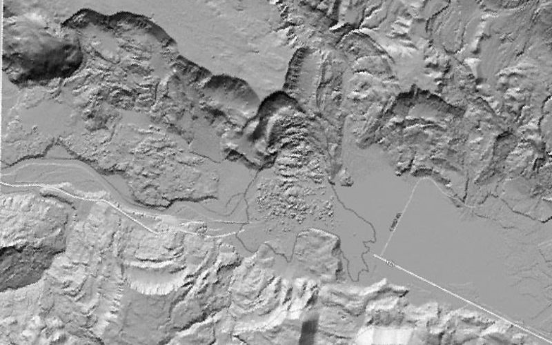
Enhanced lidar image from the aftermath of Superstorm Sandy, October 2012.
Examples of how each state benefits from current high accuracy elevation data are explained in the 24 3DEP state fact sheets available on the 3DEP or The National Map websites. Those states include:
Remaining state-specific fact sheets will continue to be released in the near future.
The use of 3DEP technology has been recommended and endorsed by National Digital Elevation Program Committee and its 12 member agencies, the National States Geographic Information Council, the Management Association for Private Photogrametric Surveyors and the National Geospatial Advisory Committee.
Since 1990, USGS has collected National Elevation Data and has the Federal lead responsibility for terrestrial elevation data. The 3DEP project is designed to fulfill that coordination responsibility and to assure the Nation receives the essential high quality coverage.
For more information, visit the 3D Elevation Program (3DEP) website.