 SEATTLE, Wash. — Feb. 9, 2015 —LizardTech®, a provider of software solutions for managing and distributing geospatial content, has released an update to its free iOS GeoViewer application for viewing geospatial imagery and vector overlays.
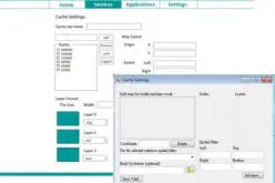
GeoViewer for iOS enables iPad, iPhone, and iPod Touch users to view MrSID and JPEG 2000 imagery on their mobile devices. GeoViewer includes measurement tools, image band selection, and more. The latest release includes free support for bookmarks and base maps. You can purchase additional functionality like displaying web map service (WMS) imagery, area measurement, and address search via a single in-app purchase. The in-app purchase is $4.99 and also includes support for additional projection systems and tracking your current location for measurement purposes.
To download GeoViewer for iOS, visit our website or the iTunes Store.
About LizardTech
Since 1992, LizardTech has delivered state-of-the-art software products for managing and distributing massive, high-resolution geospatial data such as aerial and satellite imagery and LiDAR data. LizardTech pioneered the MrSID technology, a powerful wavelet-based image encoder, viewer, and file format. LizardTech has offices in Seattle, Denver, London and Tokyo. For more information about LizardTech, visit www.lizardtech.com.
#########
© 2015 Celartem, Inc. d.b.a. LizardTech. All rights reserved. LizardTech, MrSID, GeoExpress, Express Server, Spatial Express, and Express Suite are registered trademarks in the United States and LiDAR Compressor and the LizardTech, GeoExpress, Express Server, Spatial Express, Express Suite, LiDAR Compressor, ExpressView and GeoViewer logos are trademarks, and all are the property of Celartem Inc. dba LizardTech. Unauthorized use is prohibited.
All other trademarks are property of their respective owners.