 To meet the demands of global GIS professionals and developers, Supergeo provides with SuperGIS Engine 3.3, the COM-structured development kit, bringing various GIS developing elements, application resources and sample modules to assist developer to meet the diverse demands of different projects and products.
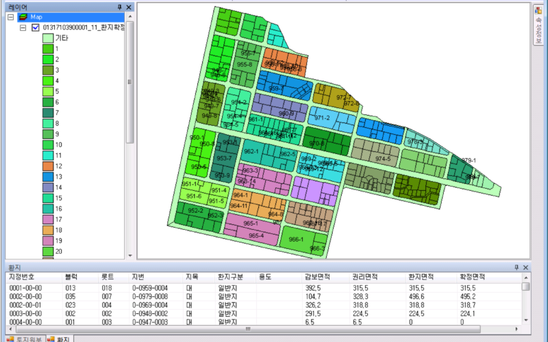
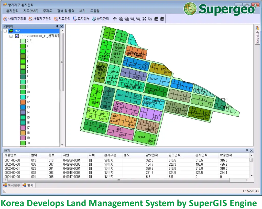
T&B Radio Tech, Supergeo certified reseller in Korea, developed the unique Land-Replotting Management System by SuperGIS Engine 3.3. The developer utilizes the abundant components,especially designed for GIS-related needs, and redesigns its surface to satisfyclients’ requirement. With the system, land planers are able to easily manage parcellary data and maps.
The latest SuperGIS Engine 3.3 had releasedand adding up multiple functions and fully-strengthened the existing core objects, such as upgrading the database support and connection efficiency,improving table processing and provides more user configuration options.
Meanwhile, to cope with the particular needs of personnel, SuperGIS Engine 3.3 offers comprehensive development samples and object diagram for technical users to effectively build programs and deploy to multiple end-users.
Develop Customized GIS System: http://www.supergeotek.com/download_6_developer.aspx
More resources for developer, full in Supergeo Developer Network: http://sgdn.supergeotek.com/
# # #
About Supergeo
Supergeo Technologies Inc. is a leading global provider of GIS software and solutions. Since the establishment, Supergeo has been dedicated to providing state-of-the-art geospatial technologies and comprehensive services for customers around the world. It is our vision to help users utilize geospatial technologies to create a better world. Supergeo software and applications have been spread over the world to be the backbone of the world’s mapping and spatial analysis. Supergeo is the professional GIS vendor, providing GIS-related users with complete GIS solutions for desktop, mobile, server, and Internet platforms.