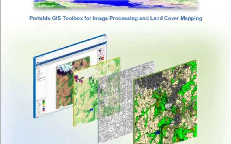
IMPACT: Open-source Software for Image Processing and Land Cover Mapping
The image processing and land cover mapping community can enjoy a new free software developed by the EU Joint Research Centre.
The IMPACT tool is a portable browser-based application for image processing, visualization and mapping running under Microsoft Windows (Xp,Vista,Win7,Win8,Win10).
IMPACT toolbox offers a combination of elements of remote sensing, photo interpretation and processing technologies in a portable and stand-alone GIS environment. Image extraction, layer stack, radiometric calibration, normalization, mosaicking, automatic classification, and segmentation could be easily performed while a user-friendly environment offers map editing and validation features.
The rational for this development has been the strong link between the JRC projects to monitoring forests in the tropical belt (TREES; FOROBS; ReCaREDD) and partner forest national services, where capacities to procure, maintain and exploit image processing and GIS packages remain weak.
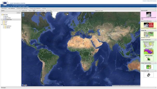
Based on open sources technologies, IMPACT relies on GeoExt, OpenLayers and MapServer for the graphical user interface and raster/vector rendering; EO data processing is carried out by GDAL and Python. Single-date or multi-date segmentation is performed throughout Baazt segmenter libraries (Inpe’s TerraAIDA Operators).
The user-friendly toolbox offers map editing and validation features. The IMPACT toolbox is distributed under the Free/Open Source Software License (GNU General Public License – GPLv3).
No installation or virtual machines are required and therefore the package can be copied onto a portable device for easy execution and data sharing. Internet connection is not essential although might offer access to additional information such as very high-resolution WMS layers from Google or other sources.
Download IMPACT
Source – Joint Research Centre