ILMF 2017: YellowScan launches YellowScan LiveStation,
Real-time in-flight LiDAR Station, a must for long endurance and critical LiDAR flights
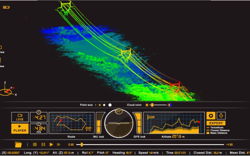
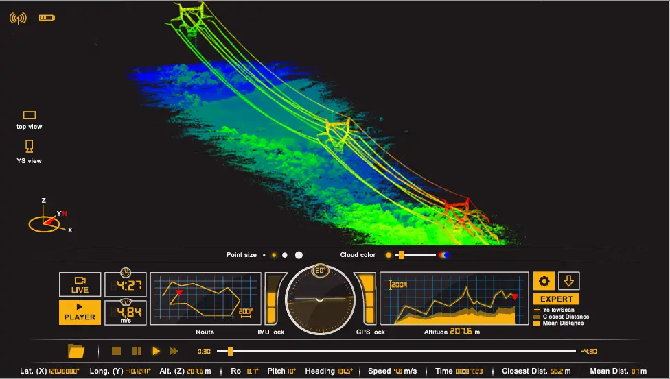
Yellowscan is very pleased to announce the launch of the YellowScan LiveStation, enabling Surveyors to monitor in real time the validity and quality of the data being collected, to ensure that the survey is going smoothly:
- Live 3D point cloud visualization (including zooming, translation, rotation)
- Live transect and trajectory visualization
- Speed, altitude, IMU & GNSS controls
- Mission replay
YellowScan LiveStation will be presented at the International LiDAR Mapping Forum (ILMF 2017) in Denver, CO:
- Product Preview Presentations on Monday February 13th at 9:30 am
- In flight LiDAR workshop on Thursday February 16th, 8:30-12:30, in Golden, CO (please register on www.yellowscan.fr or http://juniperunmanned.com/
trainings/yellowscan) - Mission Replays on our ILMF booth #35, Feb 13-15
Designed by surveyors for surveyors, for complex and long endurance flight operations, YellowScan LiveStation uses cutting-edge visualization design.
YellowScan LiveStation provides system operators with the immediate and relevant information needed to ensure a smooth acquisition even in difficult working conditions.
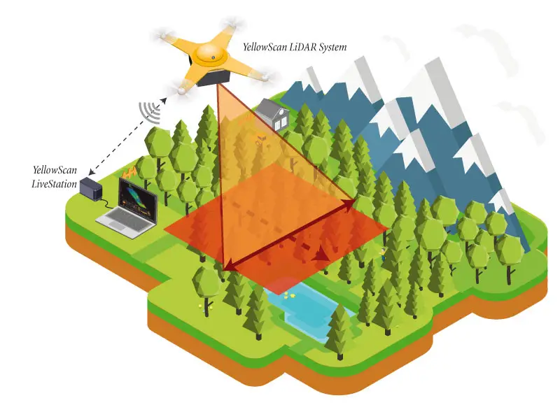
YellowScan LiveStation renders a real-time, three-dimensional representation of the point cloud during flight, with ability to zoom, translate or rotate. Simultaneously, the user interface presents an immediate summary of the system’s status.
The transect view easily allows the operator to check in real-time whether the LiDAR is able to penetrate a forest’s canopy and sample its ground.
Missions can later be replayed for analysing flight conditions and data.
———————–
At YellowScan we design, develop and produce UAV Mapping solutions for professional applications. Fully integrated, ultra-light and easy to use, these highly automated data collection tools are used by customers around the world in fields such as surveying, forestry, environmental research, archeology, corridor mapping, civil engineering and mining.
With more than 12 years of field experience, YellowScan is committed to delivering the highest level of performance, reliability and robustness for its solutions. Our platforms are field tested all over the world in multiple environments (tropical forest, bare soil, mountains, rivers, coast lines, open-pit mine, power lines).
YellowScan will be exhibiting at the International LiDAR Mapping Forum (ILMF) Denver 2017, Booth 35
For more information, please navigate to www.yellowscan.fr or contact us at contact@yellowscan.fr