Gaofen-4 – China’s First High Orbit Remote Sensing Satellite Put Into Use
PTI- China’s first high orbit remote sensing satellite, Gaofen-4, said to be the world’s most sophisticated, became operational after six months in-orbit testing, it was announced today.
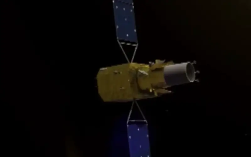
Gaofen-4 is China’s first geosynchronous orbit high- definition optical imaging satellite, state-run Xinhua news agency quoted the State Administration of Science, Technology and Industry for National Defense (SASTIND) as saying.
Unlike from Gaofen-1 and Gaofen-2 in low orbits around the earth, Gaofen-4 is orbiting at 36,000 kilometers.
High orbit satellites have the advantage of being able to snap “grand scenarios”. Low orbit satellites, in contrast, can see more detail at faster speed.
Low orbit satellites cannot always follow natural disasters, but Gaofen-4 can continuously observe a disaster because it moves synchronously with the earth, the report said, adding that it was the world’s most sophisticated satellite.
It improves the response to disasters like earthquakes, landslides and typhoons with its high-precision sensors.
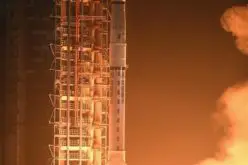
Gaofen-4, which was launched in December 2015, has a designed lifespan of eight years, compared to other remote sensing satellites which remain in service for less than three to five years.
During the in-orbit test, Gaofen-4 has been used to collect imageries of flood-hit areas in south China and monitor fires that occurred in southwest China’s Sichuan Province and in Russia.
China started the Gaofen project with the launch of Gaofen-1 in April 2013.
It aims to launch seven high-definition observation satellites before 2020, designed for disaster prevention, surveillance of geological disasters and forest disasters and weather forecast.
Gaofen-3 is set to be launched in August 2016, according to the SASTIND.