The New South Wales State Emergency Services (NSW) will have a new weapon this flood season after rolling out a high-tech mapping system that allows volunteers on the ground to instantly share critical information anytime, anywhere.
Backed with Geographic Information System technology from intelligent mapping specialists Esri Australia, the system enables NSW State Emergency Service volunteers to log in remotely from regional command centers or the field with mobile devices to input real-time, detailed geographic data.

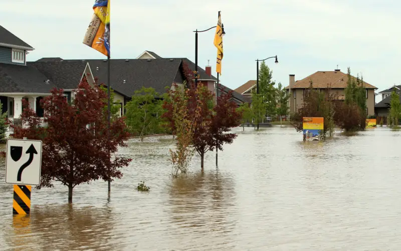
More than 20,000 people were temporarily isolated by floodwaters in January when intense rainfall caused major flooding in the Tweed and Clarence rivers affecting nearby communities.
NSW State Emergency Service GIS manager Elliott Simmons said the new technology was tested in earnest during those floods and is now ready to be extended to 229 units located throughout the state.
“When major floods occur, it presents unique challenges for incident management teams who, as well as co-ordinating frontline assistance, need to inform the wider organization of the situation around them,” Mr. Simmons said.
“With the previous system, volunteers needed to be connected to the NSW SES network in the headquarters to view critical geospatial data – and when they were out on a job, mapping features could only be described through manual communication methods.
“Now mapping volunteers deployed to forward locations can use the new system to instantly upload locally refined evacuation areas to a central system, allowing other data sets such as demographics or risks to infrastructure to be overlay and considered prior to release.”
Mr. Simmons said with the new technology now in place, the NSW SES volunteer workforce could be even more cohesive and responsive during a natural disaster. Volunteers have always been our eyes and ears on the ground, but now they have an instant mapping and reporting capability.
“Information about what is happening and where it is happening can now flow more rapidly, allowing the NSW SES to make more informed decisions in shorter timeframes, which will ultimately improve response times and community safety.”
Esri Australia NSW business manager Andrew Seit said the technology would become a powerful tool for emergency services, particularly its new social media function.
“The online mapping system has the capacity to harness Facebook, Twitter and Flickr feeds so social media can play an official role in disseminating public safety information. Community sourced data, such as social media updates, can be layered on an interactive emergency map, providing visual, real-time information of what is happening on the ground,” Mr. Seit said.
“The social media function was first used during the 2011 Queensland flood disasters where it showed enormous potential.”
Source : The Maitland Mercury