Redlands, California, May 29, 2018—Esri, the global leader in spatial analytics, today announced that it is releasing Sentinel-2 Image Services to all Esri users for no additional cost. Sentinel-2 is an Earth Observation Satellite that provides multi-spectral imagery for any location in the world at 10-meter resolution. Currently in beta, the service is updated daily with new imagery for all ground locations every 5 to 7 days. The Sentinel-2 Image Services provide temporal, multi-spectral imagery of the entire globe for improved monitoring of agricultural and forest conditions, monitoring of land cover changes, and to assist with natural disaster management.
Multispectral Imagery. Credit: Esri
Sentinel-2 is part of Copernicus, the world’s largest single Earth observation program directed by the European Commission in partnership with the European Space Agency. Esri makes the multi-spectral data quickly accessible using ArcGIS Image Server and publishes an image service through the ArcGIS Living Atlas of the World (Living Atlas), hosted on the Amazon Web Services Infrastructure. The service includes all Sentinel-2 imagery going back 14 months, enabling change to be easily reviewed. Image analysis can be run directly on the service to create indexes displaying properties such as vegetation health or soil moisture as well as quantifying the changes over time, for better understanding of the environment.
“We are committed to helping our users discover, explore, and better understand our changing planet,” said Jack Dangermond, Esri founder and president. “Pairing Sentinel-2 imagery with our ArcGIS Image Server provides a powerful platform for in-depth analysis which can inform meaningful action.”
Sentinel-2 multi-spectral imagery can provide better visualization and understanding of catastrophic events such as Hawaii’s Kilauea volcano. The ability to use imagery of the volcano along with other spatial data, such as digital elevation models (DEM), provides an unprecedented opportunity to help predict lava flow direction and provide advanced notice to those who may be in danger.
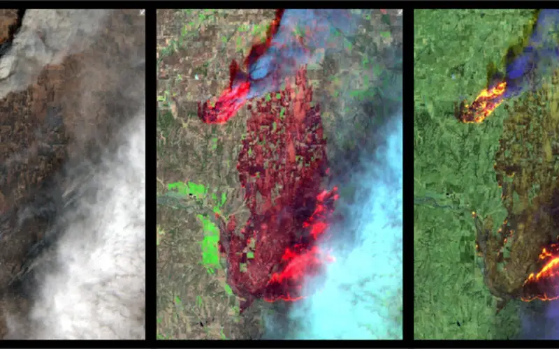
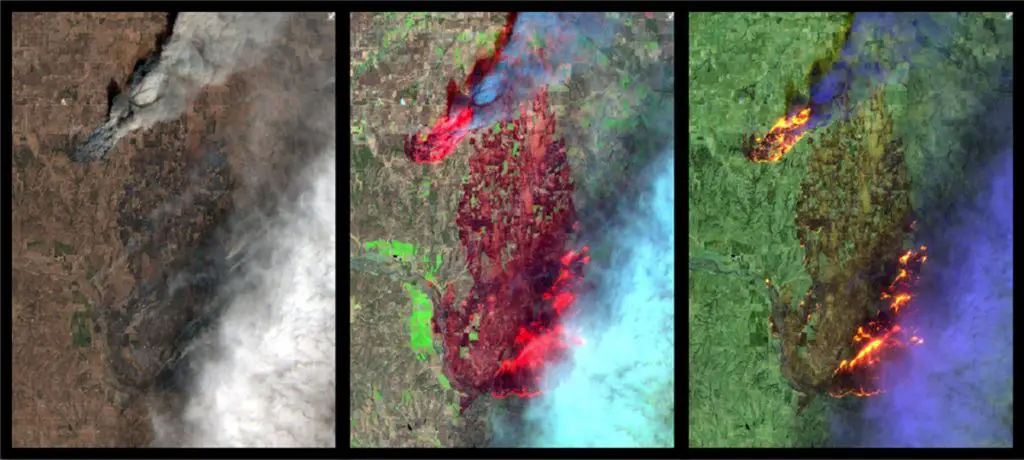
Sentinel-2 can also help provide understanding of the conditions that lead to fires such as this past winter’s Thomas Fire, which is California’s largest wildfire on record. The Thomas Fire burned over 280,000 acres and triggered massive mudslides. Visualizing factors, such as periods of increased moisture contributing to more lush vegetation followed by hot and dry weather, can help predict future wildfires and mitigate their effects in the future.
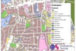
The Sentinel-2 imagery is available through the Living Atlas, the foremost collection of geographic information from around the globe. The Living Atlas is included with all ArcGIS online subscriptions. It is comprised of maps, apps, and data layers that support the work of thousands of Esri users around the world. Full service access, including a rolling 14-month archive of the Sentinel-2 data, is now available to all Esri ArcGIS users. For more information on the Living Atlas, visit go.esri.com/Sentinel.
# # #
Press Information:
Karen Richardson, Esri
Tel.: 914-841-3180
E-mail (press only): krichardson@esri.com
General Information: media.help@esri.com