
Software
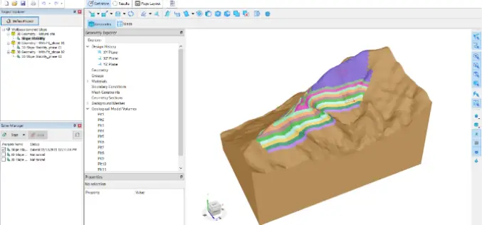
SLOPE3D: Advanced Slope Stability Analysis Tool for Safer Engineering Design
The Bentley Subsurface Company has unveiled SLOPE3D, a state-of-the-art tool for analyzing slope stability that enables geotechnical engineers and engineering geologists to design safer slopes. SLOPE3D is an upgraded version

Free and Open Source SAR Image Processing Software
This blog post will introduce best free/open source SAR Image Processing Software packages and provide a brief overview of their features.
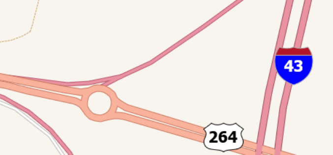
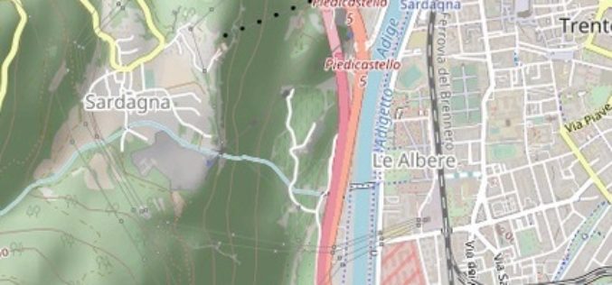
TatukGIS Integrates Road Shields
TatukGIS announces integrated support for highway and route shields in its GIS SDK and desktop GIS products. A built-in SVG symbols library provides easy access to shields commonly used to

‘KISAN’ Mobile App for Dissemination of Agromet Advisory Services
IIT Roorkee under Gramin Krishi Mausam Sewa (GKMS) project has launched the ‘KISAN’ mobile app for dissemination of Agromet Advisory Services. IIT Roorkee held a regional farmers’ awareness programme as
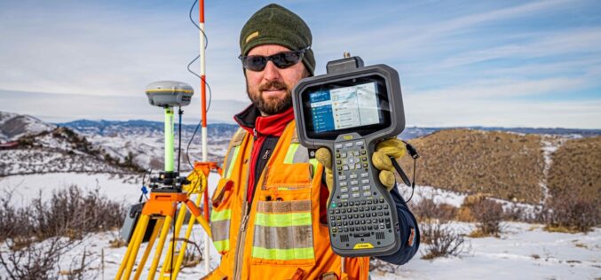
Trimble Announces Trimble TSC5 Controller, a Rugged, Lightweight Field Data Controller for Land and Construction Surveying
Trimble TSC5 Controller with 5-inch Screen, Keypad and Android Operating System Enables All-Day Field Data Collection in Harsh Environments Trimble (NASDAQ: TRMB) introduced today the Trimble® TSC5 Controller, a new
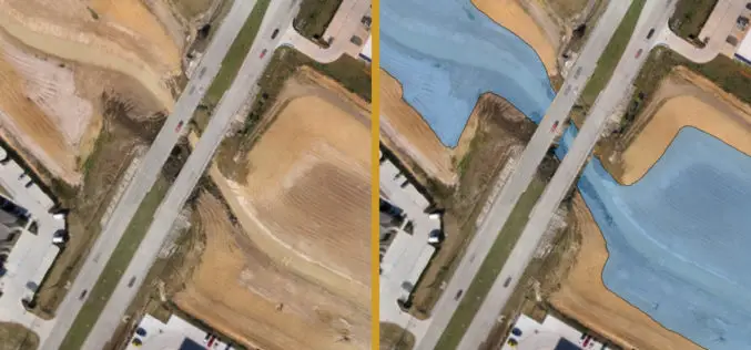
Volumetric Calculations for Stormwater Retention Ponds, Basins & Quarries
Integration with CAD Enhanced AARSCHOT, Belgium, 2 March 2020 – Virtual Surveyor has released Version 7.1 of its popular drone surveying software, introducing functionality to efficiently calculate volumetrics in quarries,
TatukGIS Hosted OpenStreetMap Tile Server
TatukGIS hosted OSM (world map) web tile servers are available as a free service for use with TatukGIS software, including custom GIS applications developed by customers using the TatukGIS Developer
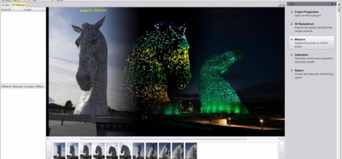
Trimble Inpho UASMaster 9.1 Now Available
UASMaster is one of Trimble’s UAS processing software solutions. UASMaster is engineered on the basis of the well-established Inpho advanced airborne photogrammetry/airborne LiDAR processing software suite. It offers full automatic geo-referencing, point-cloud
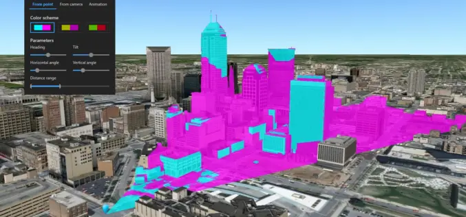
What’s New in ArcGIS Earth v1.8?
Recently Esri has introduced the latest version of ArcGIS Earth v1.8. ArcGIS Earth 1.8 delivers interactive analysis tools such as elevation profile, 3D measure, line of sight, and viewshed—with much more
Trimble’s TBC v5.00 Now Available
Trimble Business Center’s field-to-finish survey CAD software helps surveyors deliver high-accuracy GNSS data, create CAD deliverables, and leverage full data traceability throughout a project’s lifecycle. Trimble Business Center allows you
