
Business
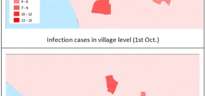
Make Your Data Persuasive With SuperGIS Desktop
With constant development in information technologies, people often worry about getting too much information instead of getting too little. The ability to sum up information into a simple but clear
OGC and ASPRS to Collaborate On Geospatial Standards; Invite Participation in Point Cloud Work
The Open Geospatial Consortium (OGC) and the American Society for Photogrammetry and Remote Sensing (ASPRS) have agreed to work together more closely in the application and promotion of standards and best practices for the

Esri Collaborates with Microsoft to Incorporate Location Services and Spatial Analytics
Internet of Things Innovation Benefits Enterprise Organizations across Industries and Verticals The Internet of Things (IoT) inspires new ways of thinking about how we work with and share information. And
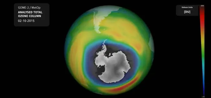
Ozone Hole Nears Record Size Again
The ozone hole over Antarctica currently extends over 26 million square kilometres – an area larger than the North American continent. Currently, it is approximately 2.5 million square kilometres larger

OGC Seeks Public Comment on Candidate 3D Portrayal Service Standard
The membership of the Open Geospatial Consortium (OGC®) seeks public comment on the candidate OGC 3D Portrayal Service (3DPS) Standard. In the last decade, progress in airborne and mobile laser
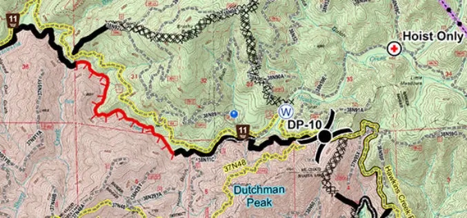
United States Forest Service Deploys the Avenza PDF Maps App for Fire-Fighting
PDF Maps app to aid firefighting and emergency response efforts The United States Forest Service (USFS) fights wildfires and other natural disasters in more than 155 national forests and 20
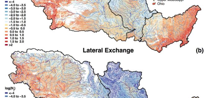
Uncovering the Mighty Mississippi’s Natural Potential for Nitrogen Removal
Working throughout the Mississippi River basin, USGS scientists and collaborators from the University of Texas at Austin have established the river’s own potential to decrease its load of nitrate and
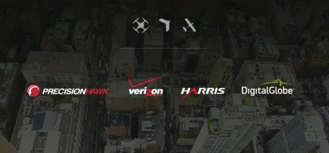
PrecisionHawk, Verizon, Harris and DigitalGlobe Jointly Demonstrate Technology for Safe Drone Operations
Industry leaders in cellular, aircraft surveillance, satellite imagery and drones bring together the best technology solutions to enhance safety as airspace congestion increases. PrecisionHawk, Verizon (NYSE, Nasdaq: VZ), Harris (NYSE:HRS)
Underground Utilities and Traffic Applications in 3D
SuperGIS 3D Earth Server is now focusing on the development of underground utilities and traffic applications. The product not only provides the ability to visualize and manage underground utilities in
The Regeneration of Open Data through SuperGIS Server
Integrating different sources of open data often generates great value and new information. For example, by integrating earthquake and tsunami locations with a coastal city vulnerability index, you will be

