
Business

OGC Calls for Participation in its Indian Interoperability Plugfest
26 December 2016: The Open Geospatial Consortium (OGC®) is calling to vendors doing business in India for participation in its latest Interoperability Plugfest. The Department of Science and Technology (DST),

ImageSat International and Ben-Gurion University to Collaborate on Miniature Hyperspectral Imaging System
Technology based on university research could lead to new generation of spectral systems for flight and space-based remote sensing BEER-SHEVA, Israel…December 27, 2016 – ImageSat International (ISI) and Ben-Gurion University
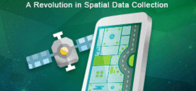
The Excellent Mobile GIS App – SuperSurv 10 Is Coming Soon
Supergeo is pleased to announce that SuperSurv, one of the most well-known mobile GIS products of Supergeo, will soon leap forward to the next generation, SuperSurv 10! Available on iOS

TerraGo Edge Version 3.9.8 Enhances Seamless Integration with Esri ArcGIS
New ArcGIS® Direct Connect feature added to ever-expanding ArcGIS integration options to easily exchange data between ArcGIS and TerraGo mobile data collection solutions Available today, TerraGo Edge version 3.9.8 now

Esri Unveils CityEngine Mobile Virtual Reality Solution
Customers Can Create and Share VR Experiences for Urban Planning Global smart-mapping leader Esri today announced a virtual reality (VR) solution for CityEngine, the company’s award-winning 3D modeling software. The

Illinois Wesleyan University Selects Geospatial Corporation’s GeoUnderground and GIS-Centric Smart-Asset Management Technologies
GeoUnderground Deployed to Improve Infrastructure Capital and Business Planning Pittsburgh Pennsylvania – December 19, 2016– Geospatial Corporation (OTCQB Symbol “GSPH”), a leading innovator of asset management/analytics/mapping software and 3D mapping

TomTom and Microsoft Join Forces to Bring Location-based Services to Azure
Amsterdam, 15 December 2016 – TomTom (TOM2) and Microsoft announced today they will partner to bring enterprise-grade location-based services to Microsoft’s Azure platform, based on TomTom’s maps, traffic and navigation

Ordnance Survey’s Ground Breaking Planning and Mapping Tool for the National Rollout of 5G Technology
The holly and the 5G Bournemouth’s Christmas tree, lights and decorations feature in Ordnance Survey’s ground breaking planning and mapping tool for the national rollout of 5G technology. Bournemouth’s Christmas tree,

NASA’s CYGNSS Launch Takes Surrey Satellite’s Space GNSS Receiver into Orbit
ENGLEWOOD, COLO. — Surrey Satellite Technology’s Space GNSS Receiver Remote Sensing Instrument (SGR-ReSI) is the primary payload onboard NASA’s CYGNSS constellation, launched today, December 15. The Cyclone Global Navigation Satellite System
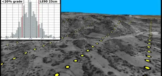
PhotoSat Publishes 21 New Satellite Surveying Accuracy Studies
21 PhotoSat surveying accuracy studies from seven different stereo satellites PhotoSat has published 21 new satellite surveying and mapping accuracy studies, now available on our website. The studies include data

