
Business
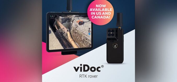
Pix4D Launches in the USA and Canada, the viDoc RTK rover, an iPhone Case that Enables Handheld Professional 3D Scanning
Pix4D, the market leader in photogrammetry solutions, has just made the viDoc RTK rover available for purchase in the USA and Canada. Already available in Europe, the German-designed rover attaches

Trimble and Microsoft Partner to Drive Digital Transformation Across Industries
Initial Focus—Companies to Develop an Industry Cloud to Enable Construction Organizations to Harness the Value of Digital Construction Data Across the Project Lifecycle from Design, Build and Operate Trimble (NASDAQ:
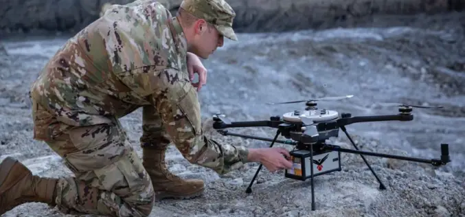
RedTail Delivers LiDAR System to DoD’s Explosive Ordnance Disposal Community
RedTail LiDAR Systems, a leader in microelectromechanical systems (MEMS) mirror-based light detection and ranging (LiDAR) technology, has delivered six LiDAR systems to the 707th Ordnance Company stationed at Joint Base Lewis-McChord. These

25 years of successful cooperation between GAF AG (Germany), DLR (Germany) and Antrix (India)
GAF, the German Aerospace Center (DLR) in Neustrelitz and Antrix Corporation have a successful cooperation stretching back 25 years. In 1996, they signed agreements for the purpose of receiving Indian Earth observation

Enhanced User Experience with New Online Map Service
PlanetObserver and Kalisio reveal My Planet Maps, a new subscription-based online map service that delivers immediate streaming access to fresh and global data. It includes performant vector and raster georeferenced

RIEGL Presents New Products at INTERGEO 2021
INTERGEO is back LIVE in Hanover this year – and RIEGL presents the latest developments in hardware and software at booth 20C.22 in hall 20 but also digital at the
Avenza Releases Geographic Imager 6.4 for Adobe Photoshop
Avenza Systems Inc., producers of the Avenza Maps ® app for mobile devices and geospatial plugins for Adobe ® Creative Cloud ®, including MAPublisher ® for Adobe Illustrator ®, is
New Lemur Release Extends Enterprise Mobile GIS Capabilities
Intuitive Critigen solution delivers enhanced data synchronization, scalability, and security for tens of thousands of field workers Critigen today announced the latest release of Lemur, its mobile GIS solution. Lemur delivers enterprise

MapMyIndia Filed DRHP with SEBI for an IPO of Around $175 Million
According to recent news by the Money Control website, an Indian technology company that builds digital map data has filed its draft red herring prospectus (DRHP) documents with SEBI on

NV5 Geospatial Expands Mobile Mapping Fleet with State-of-the-Art RIEGL VMX-2HA Platform
RIEGL today announced that NV5 Geospatial, North America’s largest geospatial data firm, has acquired the new RIEGL VMX-2HA dual scanner mobile mapping system. The solution will initially deploy in utility
