
Business
TatukGIS Releases SDK for ASP.NET Core
TatukGIS has released the ASP.NET Core edition of its GIS Developer Kernel (DK) product for developing custom web GIS applications for Windows, Linux, and macOS servers (including Docker). Support includes application development

Trimble’s New GNSS Base Station Gives Users Improved Satellite Tracking and Remote Operation for Civil Construction, Geospatial and Agriculture Applications
Trimble (NASDAQ: TRMB) has introduced the Trimble® R750 GNSS Modular Receiver, a connected base station for use in civil construction, geospatial and agricultural applications. The R750 provides improved base station
USGIF Launches 2022 Scholarship Campaign
Foundation seeks donations toward collegiate geospatial intelligence education The United States Geospatial Intelligence Foundation (USGIF) announces the launch of the 2022 USGIF Scholarship Campaign, its most ambitious fundraising effort to

Euclideon Expands to Include Bespoke 3D Geospatial Visualisation Solutions as the Industry Metaverse Rapidly Grows to Meet New Demands
The Geospatial Services market is expected to reach $215 billion by 2027, at a CAGR of 16.9% from 2020 to 2027.* The introduction of sophisticated tools such as 3D tools,
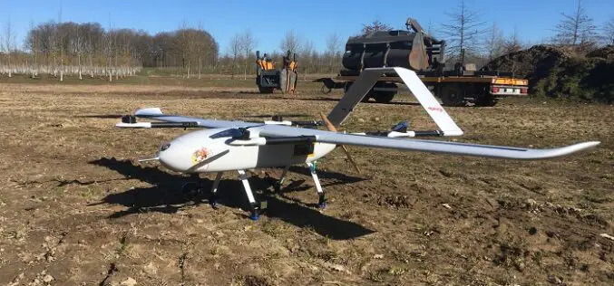
Geospatial Data: New Nationwide UAS Solution Provides Imagery at 50x the Resolution of Commercial Satellites
Beagle Systems, a Hamburg-based startup can provide on demand image data which is independent of the weather thanks to the long range sensor drones flying beneath the cloud cover. Satellites
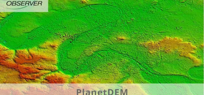
PlanetDEM – A Highly Reliable Digital Elevation Model
PlanetObserver has released PlanetDEM, its new global Digital Elevation Model (DEM) with a 30m and a 90m resolution. This new DEM offers an updated, reliable, and homogeneous 3D dataset of

Business Applications of Asynchronous Data Replication Solutions
Data Replication Solutions and the Benefits for Your Business Without turning to data replication solutions, your organization and your leadership might currently feel overwhelmed by limited data availability, low access,
Transerve Has Been Granted a Patent for Their Online Spatial Analytics Platform’s Micro-Service-Based Design
Transerve, a location intelligence firm that allows digital transformation and effective decision making, has received a patent for its invention named “System and method for revenue and asset management based

Trimble Establishes Dr. Gladys West Scholarship Program
Scholarship Program to Honor Technology Pioneer and Hidden Figure Who Helped Invent GPS Trimble announced today a scholarship program to honor Dr. Gladys West, a pioneer in mathematics, minority advancement and the
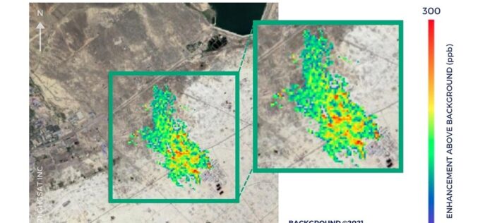
Partnership Announced by SI Imaging Services with GHGSat for Methane Emissions Monitoring
SI Imaging Services (SIIS) has embarked on a collaborative partnership with GHGSat, a Canadian satellite company specializing in greenhouse gas monitoring from space. Effective June 16th, 2021, SI Imaging Services

