
Business

DLR at Agritechnica in Hanover – Assistance from Space: Satellite Data for Digital Agriculture
Satellite information facilitates the modern management of agricultural land Agritechnica is the world’s largest trade fair for agricultural machinery, with 2900 exhibitors from 52 countries and 450,000 visitors (2015) Focus:
Orbit GT Releases 3D Mapping Feature Extraction Standard v18
Orbit GT launches the 3D Mapping Feature Extraction Standard product version 18. “We’re pleased to announce the release of our second product from the Feature Extraction portfolio”, says Peter Bonne,

Autodesk and Esri Partnering to Advance Infrastructure Planning and Design
Global Geographic Information System & Building Information Modeling Leaders Plan to Drive Integration of Spatial Intelligence and 3D Design Model Information November 15, 2017 – Redlands, California—Autodesk, Inc. and Esri, Inc.
Esri Supports the Geospatial Data Act
Legislation Provides Significant Step toward National Collaboration among the GIS Community November 16, 2017 – Redlands, California—Esri, the global leader in spatial analytics, today applauded Congress in introducing the Geospatial Data

Centrik Helps Texo DSI Evidence UAV Excellence and Boost Operational Efficiency
November 15, 2017 (Centrik)- Texo Drone Survey and Inspection Limited (Texo DSI), the owner operator of the world’s most advanced and dynamic fleet of unmanned aerial vehicles, has adopted Centrik

IIC Technologies Earns CMMI Level 3 Appraisal
IIC Technologies, has further strengthened its position as one of the reliable and efficient geospatial software solutions and service provider, by being appraised at CMMI maturity level 3. Both waterfall
Hexagon Safety & Infrastructure Unveils Safe City Framework
Integrated solutions and coordinated capabilities make cities safer and more resilient November 14, 2017 – HUNTSVILLE, Alabama – Hexagon Safety & Infrastructure unveiled its Safe City Framework at Smart City Expo World Congress, the
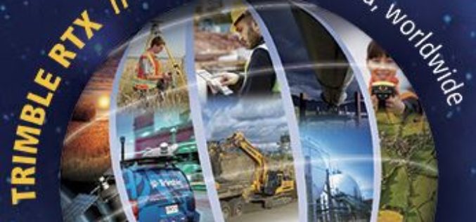
Trimble Expands CenterPoint RTX FAST Correction Service in North America and Europe
Delivers High-Accuracy, Real-Time GNSS Corrections in as Fast as One Minute SUNNYVALE, Calif., Nov. 13, 2017—Trimble (NASDAQ: TRMB) announced today the expansion of its CenterPoint® RTX Fast (RTX Fast) correction
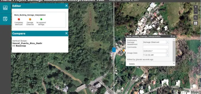
Esri Provides Mapping Technology for Students to Assess Hurricane Damage
Schools Can Use High-Resolution Imagery to Identify Where Help Is Needed to Rebuild in Puerto Rico November 9, 2017, Redlands, California – Esri, the world leader in spatial analytics, today announced it

AirMap and Kespry Partner for Safe, Compliant Drone Flights
New integration brings AirMap airspace intelligence to the Kespry platform for automated drone operations Santa Monica, CA (November 9, 2017) – AirMap and Kespry has announced a partnership that brings AirMap’s best-in-class airspace intelligence, including airspace

