
LiDAR
LiDAR for Water and Soil Conservation in Forests
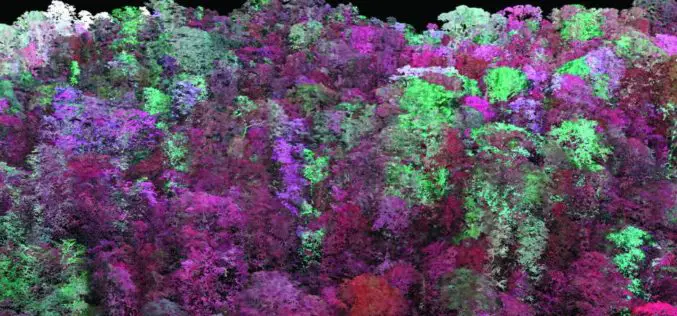
The Odisha state government is using LiDAR technology for the first time to implement soil and water conservation projects in forest areas. The initiative aims to increase groundwater recharge by
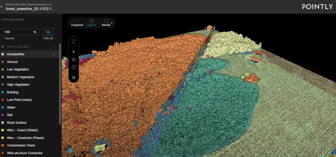
Automated Point Cloud Analysis for Forestry Mapping
Pointly has developed AI solution, that takes point clouds as input and outputs a shapefile with the location of tress for forestry mapping.
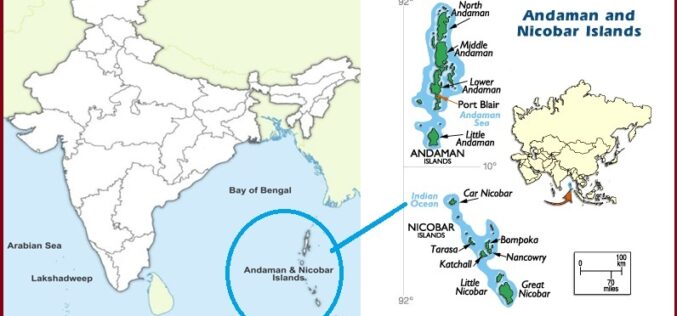
India Plans for Airborne Radar Survey of Andaman and Nicobar Islands
Speaking in Lok Sabha, Jitendra Singh Minister of State (independent charge) for Science and Technology and Earth Sciences Ministry said that the Government of India is planning to conduct an
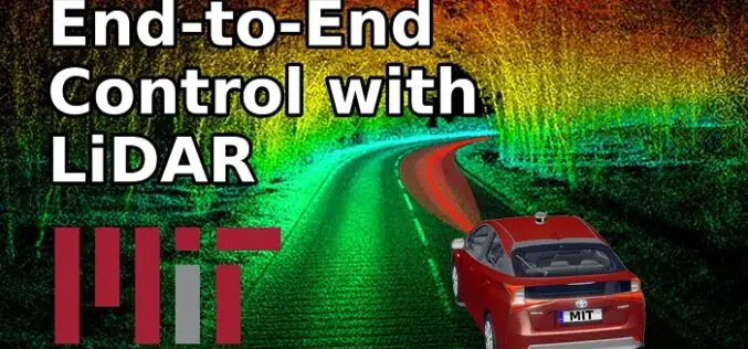
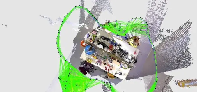
How MIT using LiDAR and ML for More Efficient Self-driving Car?
A LiDAR (Light Detection and Ranging) system beams light out and then precisely monitors the timing of reflections to map and track objects within its detection range. A LiDAR instrument principally
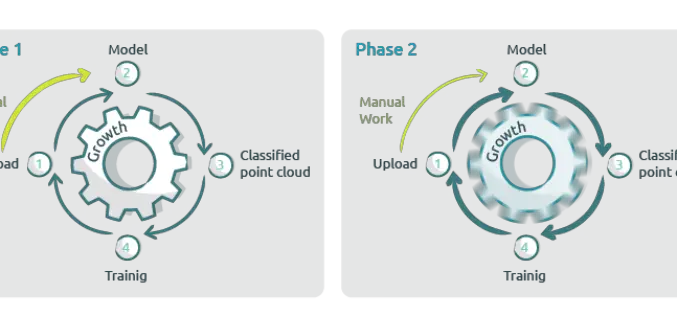
New Pointly AI Training Service for Efficient Point Cloud Classification
Pointly recently introduced a new AI Training Service to extend their Pointly Service offering. This Service offers you not only automated and customer-specific classifications of point clouds but also tailor-made
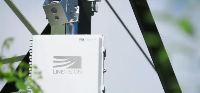
LiDAR Sensor to Protect Vital Electrical Utilities
Velodyne and LineVision have signed an agreement to provide sensors to protect electric utilities and help to improve electric utility operations.

Upcoming Self-Driving Volvo Cars to be Supported by LiDAR for Safety
In collaboration with technology firm Luminar, leading automobile manufacturer Volvo is releasing a new car in a couple of years with cutting-edge perception technology that could finally see self-driving cars on public roads.

Kochi Metro Rail Completes LiDAR Survey for Kochi Water Metro
Kochi, the commercial capital of Kerala is the second-largest city along India’s western coastline, after Mumbai. The backwaters network of brackish lagoons and lakes lying parallel to the Arabian Sea
What is SLAM Algorithm and Why SLAM Matters?
SLAM or Simultaneous Localization and Mapping is an algorithm that allows device/robot to build its surrounding map and localize its location on the map at the same time.

Apple iPad Pro LiDAR scanner – Why and How it Works?
Apple has launched its most advanced iPad Pro in the mid of March 2020. Maintaining its legacy, the new iPod Pro many new advanced features such as an Ultra
