
GIS
Trivim – A Free and Open Source Software for 3D Street Model Generation
Trivim (Alpha) is a free and open source software for 3D Street Model Generation. Trivim is developed by Indian Institute of Remote Sensing (IIRS). Indian Institute of Remote Sensing (IIRS) under Indian Space Research
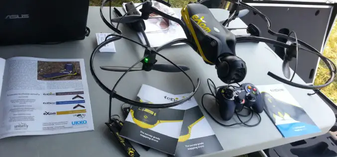
UAV-g 2015 International Conference: Thrilling Success
UAV-g 2015 International Conference, York University, Toronto, Aug 30-Sep 2, 2015 The UAV-g 2015 International Conference of Unmanned Aerial Vehicles in Geomatics with the theme Small Unmanned Aerial Systems (sUAS):

Digital Library of Indian Maps Soon to be Live: NATMO
The National Atlas and Thematic Mapping Organisation (NATMO) is developing a digital library of Indian maps and will make availability of e-maps to the citizens within a year. NATMO prepare atlases
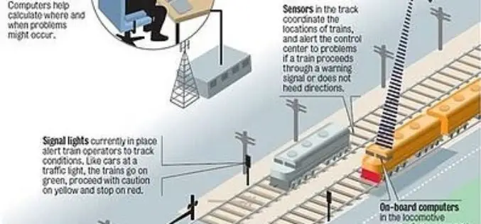
Indian Railways to Tie Up With ISRO for Enhanced Safety Using GPS Aided System (GAGAN)
Indian Railways will join hands with ISRO to get online satellite images for improving safety and enhancing efficiency. “We will undertake a massive exercise of GIS mapping of the entire
India to Launch Multi-Spectral Remote Sensing Indonesian Satellite
Kuala Lumpur: India will launch a second multi-spectral remote sensing Indonesian satellite that will help the country to monitor land-use, natural resource and in disaster mitigation. The indigenously-made LAPAN A2/Orari

New Elevation for Nation’s Highest Peak plus 1 more
A new, official height for Denali has been measured at 20,310 feet, just 10 feet less than the previous elevation of 20,320 feet which was established using 1950’s era technology.
Why Greenwich Meridian Have Longitudinal Shift?
In 1884, the International Meridian Conference recommended that the prime meridian “to be employed as a common zero of longitude and standard of time-reckoning throughout the globe” pass through the
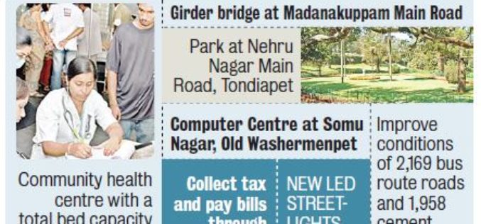
GIS Route to Shore up Tax Revenue
The Corporation of Chennai has passed a resolution to use Geographical Information Systems (GIS) in property assessment and tax collection. At present, property values are calculated based on data collected
Access to Marine Data Stream from EUMETSAT User Information Day
The Copernicus team would like to remind interested stakeholders that there are only a few days left to register for the “Copernicus Users Information Day on Access to Marine Data
Esri Nonprofit Organization Program
The Esri Nonprofit Organization Program (NPO) is designed to provide qualified nonprofit organizations with an affordable way to acquire Esri software. Qualified nonprofit organizations include noncommercial entities working on humanitarian,
