
GIS
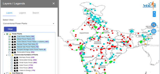
Geospatial Energy Map of India for Effective Planning of Resources
NITI Aayog in collaboration with the Indian Space Research Organisation (ISRO) has developed a comprehensive Geographic Information System (GIS) Energy Map of India with the support of Energy Ministries of Government
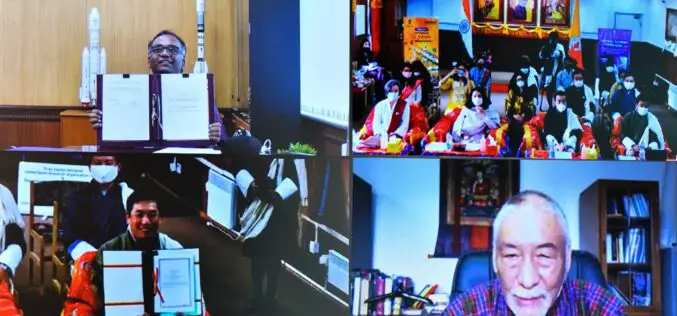
India Signed Arrangement on the Joint development of a Small Satellite for Bhutan
India signed the implementing arrangement on the joint development of a small satellite for Bhutan. The agreement was inked by Shri R Umamaheswaran, Scientific Secretary, Indian Space Research Organisation, and
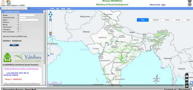
Yuktdhara – New Geospatial Planning Portal for MGNREGA
Recently the Minister of Rural Development and Panchayati Raj Giriraj Singh has launched “Yuktdhara” a new geospatial planning portal to facilitate MGNREGA assets mapping using remote sensing and geographic information
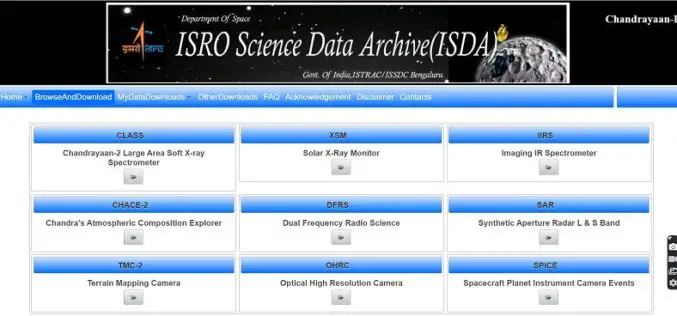
ISRO Inviting Proposals for Utilizing Chandrayaan-2 Data for Scientific Analysis
ISRO has made Chandrayaan-2 Orbiter payloads data available to the public for scientific analysis. The Chandrayaan-2 mission was successfully launched on 22nd July 2019 at 14:43 hrs by GSLV MkIII-M1

Onlinemaps Portal, SARTHI, and MANCHITRAN – Launch of 3 Online Applications to Purchase Geospatial Data Collected by Govt. Organizations
The Govt. of India in Feb 2021 announced the liberation of the Geospatial Policy of India. It has announced a new Geospatial policy to unlock new avenues for business, private

Mobile App to Boost the Cardamom Growth and Help Farmers with Site-specific Recommendations
According to recent news by The Hindu, the Spices Board and Rubber Board has signed a memorandum of understanding (MoU) with the Digital University of Kerala. The MoU was signed
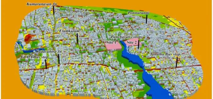
GIS-based System for Optimal Site Selection of Sewage Treatment Plants
Kerala Water Authority (KWA) has come-up with a new tool using Geographical Information System (GIS) for optimal site selection of Sewage Treatment Plants (STP). A GIS is a system designed
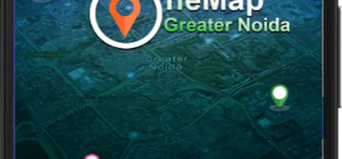
Greater Noida Launches Citizen-Centric GIS Mobile App – GNIDA GIS
Greater Noida becomes the first Smart City in Nation Capital Region (NCR) to launch a citizen-centric GIS Mobile App. Citizens of the Greater Noida city can get information of plots

Technology Connecting Farmers to a Friend at High Heavens – A Talk with Ankur Omar, Founder of Farmonaut
GIS Resources had a questionnaire with Ankur Omar, Founder of Farmonaut. He has shared some interesting insights about Farmonaut.

Intermap and TATA Communications Signed Agreement for 5G Network
Initially Intermap will support TATA’s expansion of its 5G network in selected Indian cities.

