GeoPackage now a supported format
Toronto, ON, September 13, 2016 – Avenza Systems Inc., producers of the Avenza Maps app for mobile devices and geospatial plug-ins for Adobe Creative Cloud, including MAPublisher® 9.8 for Adobe Illustrator®, is pleased to announce the release of Geographic Imager 5.1 for Adobe Photoshop®. This latest update includes many new features including full compatibility with the latest Adobe Photoshop Creative Cloud 2015.5 release. This release also introduces the ability save and export to the GeoPackage format, a platform-independent database that can contain raster data.

“We’re pleased to release Geographic Imager 5.1 with full compatibility for the latest Adobe Photoshop CC 2015.5 update,” said Ted Florence, President of Avenza. “We’ve increased our efforts to make our products compatible with the latest updates to the Adobe Creative Cloud platform,” he added. “We’re committed to providing our users with the best map production tools possible so that they keep creating visually stunning maps.”
Enhancements and new features of Geographic Imager 5.1
- Fully compatible with the latest Adobe Photoshop CC 2015.5 release
- Greatly improved WMS functionality and usability:
- Dynamic preview zoom into selected area for image download
- Expanded list of supported services including worldwide coverage with OSM WMS
- WMS services can now be managed and organized into folders and categories
- Support for https-based services
- GeoPackage format is now supported as a Photoshop save type
- Improved Export to Web Tiles includes support for popular GeoPackage format tiling schema
- Improved GeoCrop with dynamic preview zoom and enhanced cropping tools
- Geographic Imager panel options menu returns for CC 2015.5
- Various user interface and usability enhancements
More about Geographic Imager for Adobe Photoshop
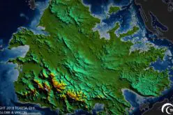
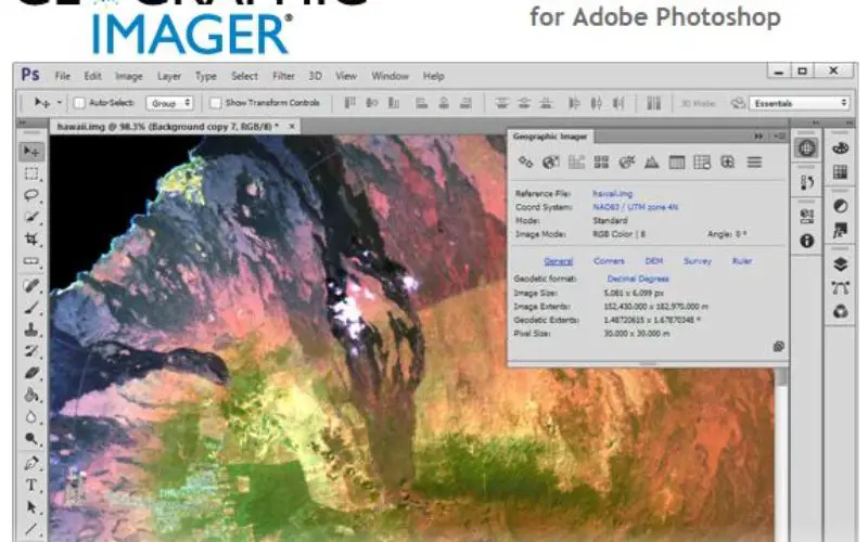
Geographic Imager is software for Adobe Photoshop that leverages the superior image editing capabilities of the world’s premier raster-based image editing software and transforms it into a powerful geospatial production tool. Work with satellite imagery, aerial photographs, orthophotos, and DEMs in GeoTIFF and other major GIS image formats using Adobe Photoshop features such as transparencies, filters, and image adjustments while maintaining georeferencing and support for hundreds of coordinate systems and projections.
Geographic Imager 5.1 is immediately available and free of charge to all current Geographic Imager Maintenance Program members and at US$319 for non-maintenance upgrades. New fixed licenses start at US$699. Geographic Imager Basic licenses start at US$99. Academic, floating and volume license pricing are also available. Visit www.avenza.com/geographic-imager for more details.
More about Avenza Systems Inc.
Avenza Systems Inc. is an award-winning, privately held corporation that provides cartographers and GIS professionals with powerful software tools to make better maps. In addition to software offerings for Mac and Windows users, Avenza offers value-added data sets, product training and consulting services, as well as the Avenza Maps app for purchasing and using maps on iOS, Android, and Windows devices. Visit www.avenza.com for more details.