
Posts From GIS Resources
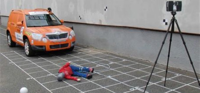
3D Mapping to Investigate Traffic Accident Cases
Singapore – According to recent news by The Star Online, traffic police officers from the Fatal Accident Investigation Team (FAIT) of Singapore are recreating event of accident site using 3D

TerraGo Edge 4.0 Re-Imagines the User Experience, Adds New Mobile Features and Expands ESRI® ArcGIS® Integration Options
Using a customer-driven, agile feedback loop, TerraGo Edge undergoes a complete redesign, improves every aspect of the user experience to help get work done faster, easier and more efficiently than
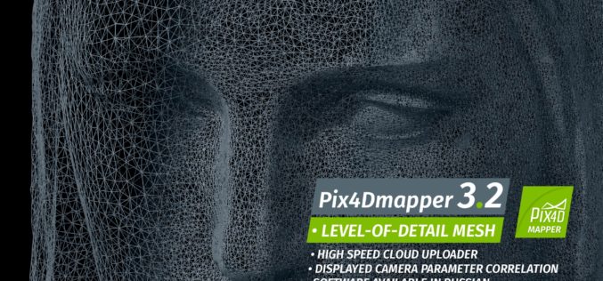
Pix4Dmapper 3.2 Now Generates Tiled Level-of-Detail (LoD) Mesh
May 2, 2017 – Today, we are happy to announce our Pix4Dmapper Desktop 3.2 release. The new version has great advancement in stability and usability – Upload desktop projects to cloud

China Adopts Revised Surveying and Mapping Law – Protecting National Security & Raising Public Awareness
China – April 28, 2017 – China’s top legislature Thursday passed a revised surveying and mapping law, protecting geographic information security and raising public awareness of national territory. The legislation
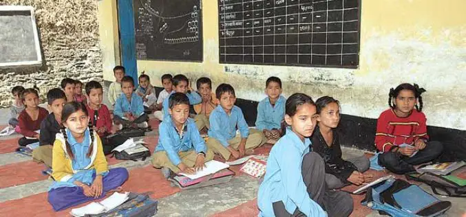
Uttar Pradesh: New Government Schools Only After GIS Mapping
Uttar Pradesh, India – According to recent news by The Hindustan Times, Uttar Pradesh will now get new government-run primary and upper primary schools only after completion of Geographic Information System
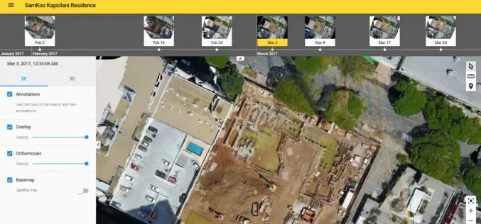
More efficient construction management with Pix4Dbim
More efficient construction management with Pix4Dbim The importance of easy data visualization for Jobsite documentation Project info Project Description A volcanic archipelago in the Central Pacific of only 11,000 square miles, Hawaii
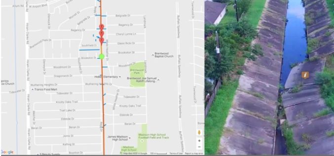
Georeferenced Video, an Alternative to Aerial Photogrammetry
Contributed By:- According to the Texas Comptroller, the state of Texas spends nearly $6 million per year on public infrastructure, including highways and other repairs and maintenance activities. Local spending
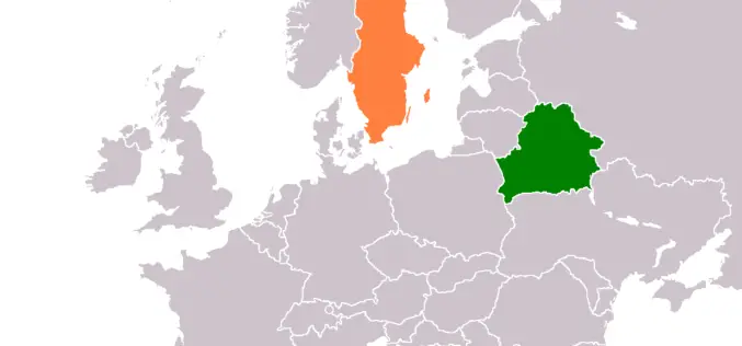
Belarus, Sweden to Share Experience in GIS Development
MINSK, 26 April (BelTA) – Belarus and Sweden will exchange experience in geographic information systems (GIS) development, BelTA learned from Belarus’ State Property Committee. A delegation of specialists of the
CartoPac Unveils Barcode Scanner Solution for Gas Utility Pipeline Mapping
CartoPac Unveils Barcode Scanner Solution for Gas Utility Pipeline Mapping Integrated Hardware, Software Included FORT COLLINS, Colorado, USA, 27 April 2017 – CartoPac International Inc., an enterprise mobile software and
University of Guelph: Prof. John Lindsay Develops Whitebox Geospatial Analysis Tools for Processing Geospatial Data
Professor John Lindsay has developed a one-of-a-kind software package called Whitebox Geospatial Analysis Tools for processing geospatial data that he says has put the University of Guelph on the map

