
Posts From GIS Resources

OGC Has Approved the New 3D Portrayal Service Standard
October 4, 2017 – The membership of the Open Geospatial Consortium (OGC®) has approved the 3D Portrayal Service (3DPS) 1.0 standard. Viewing 3D geospatial content from diverse sources has just become

Goa-based Transerve Technologies Raises $1.6mn Funds
Panji, Goa – According to recent news by the TOI and SMEPost.com, Goa-based Transerve Technologies, a company that offers geospatial technology-based SaaS solutions for sustainable growth and urban planning, has raised
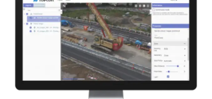
Topcon Announces New Web-Based Service for Mass Data Processing Software
LIVERMORE, Calif., U.S./ CAPELLE A/D IJSSEL, the Netherlands – September 26, 2017 – Topcon Positioning Group announces a new web-based service for integration with the MAGNET® Collage desktop mass data processing

OSGeo Signs MoU with U.S. Department of Interior
Osaka, Japan, 29 September 2017: The Open Source Geospatial Foundation has signed a Memorandum of Understanding with the United States Department of Interior (DOI). The agreement enables both organizations to

Geospatial Technology to Support National Mission for Clean Ganga
September 29, 2017 – New Delhi – (IANS) – Union minister of state for Water Resources, River Development and Ganga Rejuvenation Satyapal Singh on Thursday asked the officials of National Mission

Reliance Energy Launches App for Complaints on Defective Street Lights
September 28, 2017, Mumbai – (IANS) – In an effort to make Mumbai streets safer after dark, Reliance Energy has launched a new app-based service for lodging complaints on defective street lights,

Pix4D Announces a New User Certification Program
Drone technology is rapidly evolving and our technology is changing daily. Being a Pix4D certified user will allow users to benchmark their skills and technical knowledge of drone mapping photogrammetry.

Global Mapper v.19 Now Available with New Attribute Table Editor and Interactive Hillshade Rendering
Blue Marble Geographics is pleased to announce the release of Global Mapper version 19. With numerous functional improvements and performance enhancements throughout the application, the version 19 release is further

Trimble GNSS Smart Target Base Station Provides Simplified Map Production from UAVs
High-Performance GNSS Reference Station and Ground Control in One Easy-to-Deploy Package BERLIN, Sept. 26, 2017—Trimble (NASDAQ: TRMB) announced today the release of the Trimble® GNSS Smart Target Base Station for
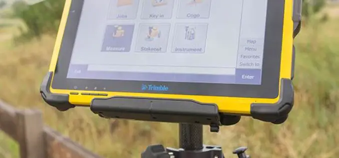
Trimble Introduces High-Performance T10 Tablet for Geospatial Field Applications
BERLIN, Sept. 26, 2017—Trimble (NASDAQ: TRMB) introduced today the Trimble® T10 tablet, a rugged, high-performance data processing platform suitable for a variety of survey and Geographic Information System (GIS) applications.

