
Posts From GIS Resources
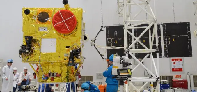
China Launched the 2nd Remote Sensing Satellite for Venezuela
According to recent news reported by Sputnik, China launched the second Venezuela Remote Sensing Satellite (VRSS-2) using a Long March-2D (Chang Zheng-2D) launch vehicle on October 09, 2017. Also known by

Remote Sensing Technology to Protect Frankincense Trees
According to recent news by Muscatdaily.com, the Remote Sensing and GIS Research Center (RSGISC) at the Sultan Qaboos University, Muscat, is assessing the use of remote sensing and GIS technology in
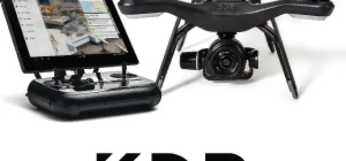
Register for the 3DR Site Scan Training Webinar
Join 3DR for the Site Scan Manager Training Webinar on Wednesday, October 11th, at 10:00 am PDT (convert to your timezone) 3D Robotics is an American company headquartered in Berkeley, California that provides enterprise

Geovation Challenge: Turn Your Great Idea into a Great Business
If you’re a UK start-up and want to help solve pressing issues using location information; the Challenge could be perfect for you. You might be an innovator with a passion for

ESA Invites Proposals to Promote Scientific Exploitation of Satellite Data
ESA’s EO Science for Society programme aims to promote scientific exploitation of satellite data, pioneer novel applications and develop pre-commercial services while maximising the use of information and communications technologies. In
Pakistan to Launch First Remote Sensing Satellite in 2018
According to recent news by the Geo.tv, the Pakistan Space and Upper Atmosphere Research Commission (Suparco) has recently announced that Pakistan’s first optical remote sensing satellite PRSS-1 would be launched in 2018. The
Hexagon Acquires Luciad, a Leading Provider of 5D Visualisation and Analysis Solutions
04 October 2017 – Stockholm, Sweden – Hexagon AB, a leading global provider of information technologies that drive productivity and quality across geospatial and industrial enterprise applications, announces the acquisition of Luciad,
Col-East Taps Extensive Image Archive to Create Multi-Function Maps
NORTH ADAMS, Massachusetts, 4 October 2017 – Col-East International Ltd., a provider of aerial photogrammetric services in the Northeast U.S. since 1952, tapped into its extensive archive of aerial imagery

GeoSLAM and Bentley Systems Join Forces to Take Mobile Reality Modelling Indoors
BENTLEY YII 2017, SINGAPORE, OCTOBER 5, 2017 – GeoSLAM – the experts in “go anywhere” 3D mobile mapping technology, and Bentley Systems, a leading global provider of comprehensive software solutions for advancing infrastructure,

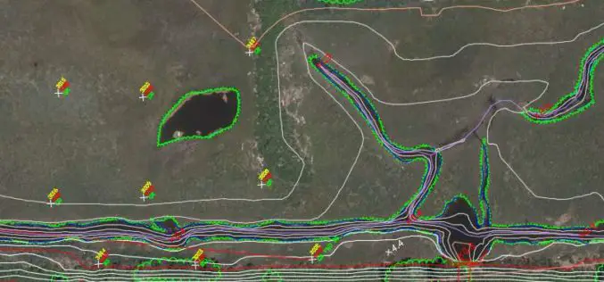
SimActive Announce the Release of Correlator3D™ version 7.0
SimActive Inc., is pleased to announce the release of Correlator3D™ version 7.0, with complete redesign of its 3D generation engine enabling substantial quality and speed improvements. Version 7.0 also includes

